
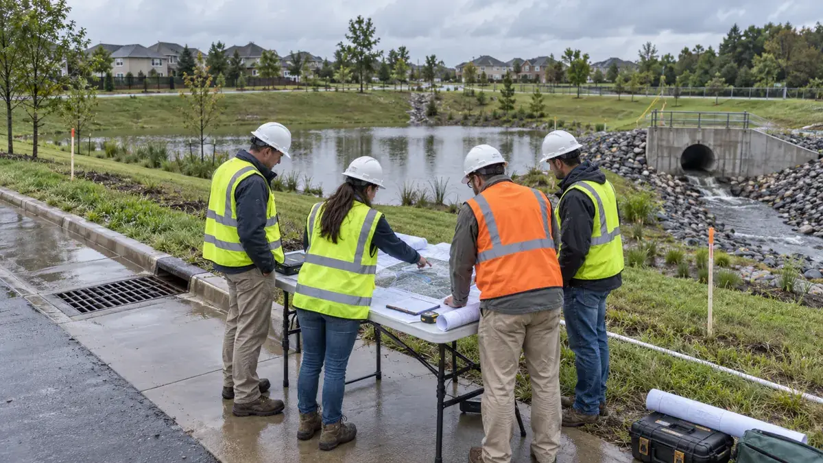
Municipal flood mitigation work often starts with a familiar problem: repeated street flooding, yard drainage complaints, overtopped culverts, undersized storm sewer segments, neighborhood ponding, or public buildings that stay vulnerable during intense rainfall. The need may be obvious to residents and public works staff, but obvious need is not the same as a fundable, design-ready project.
Before a city, county, utility district, or drainage authority asks elected officials to commit capital dollars, submits a grant application, or authorizes engineering design, the project needs a clear planning record. That record should explain what is flooding, why it is flooding, who is affected, what has already been documented, what alternatives were considered, and what decision is being requested.
Flood mitigation project scoping sits between complaint response and final design. It is not a substitute for hydrologic and hydraulic modeling, permitting, easement review, environmental documentation, or engineering judgment. It is the practical step that helps a community define the problem well enough to decide whether a project should move forward, what additional study is needed, and how the project fits local priorities.
For municipalities, scoping helps staff compare drainage needs across neighborhoods instead of reacting only to the loudest complaint. For developers and property owners, it clarifies when a site issue is part of a larger public drainage system. For public works directors, engineers, planners, and grant writers, it organizes the facts that make later funding conversations more defensible.
The goal is simple: before a flood mitigation project is described as shovel-ready, grant-ready, or ready for council approval, the community should be able to show the basis for that claim.
Who This Affects
Flood mitigation scoping affects a wider group than the engineering department alone. Drainage and localized flooding problems usually cross parcel lines, maintenance responsibilities, public infrastructure, private development, emergency response, capital planning, and community expectations.
This issue commonly affects:
- Public works directors responsible for drainage complaints, culvert replacements, storm sewer maintenance, and capital project recommendations.
- City and county engineers asked to determine whether flooding is caused by capacity, grading, maintenance, downstream constraints, or a combination of factors.
- Planning departments reviewing redevelopment, subdivision, infill, and public facility projects in areas with known drainage concerns.
- Stormwater utility managers trying to connect service fees, asset condition, and public expectations to a transparent project list.
- Grant writers and administrators preparing documentation for flood mitigation, resilience, watershed, or infrastructure funding opportunities.
- Elected officials who need clear, nontechnical explanations of why one drainage project is being advanced before another.
- Emergency management staff comparing repeated flood response areas with long-term mitigation opportunities.
- Developers, property owners, HOAs, and facility managers whose sites may contribute to, receive, or be constrained by off-site runoff.
- Consultants preparing drainage studies, benefit-cost inputs, preliminary opinions of probable cost, or alternatives analyses.
The same scoping discipline is useful for a small culvert replacement, a neighborhood storm sewer upgrade, a detention retrofit, a regional channel improvement, a green infrastructure corridor, or a flood-prone public facility project. The level of detail should match the project risk, cost, and decision point, but the core questions stay consistent.
The Stormwater Planning Issue
Flood mitigation projects often struggle because communities move too quickly from problem recognition to preferred solution. A resident reports recurring street flooding. A staff member remembers that the culvert is old. A preliminary estimate gets discussed. A grant opportunity appears. Suddenly the project is being described as necessary, urgent, and ready, even though the supporting record may still be thin.
That creates several planning problems.
First, the cause of flooding may not be fully understood. Localized flooding can result from undersized pipes, blocked inlets, flat grades, outlet restrictions, tailwater from downstream channels, filled swales, high groundwater, lack of overland relief, failed private drainage features, or land use changes upstream. A project that addresses only the most visible symptom can leave the underlying problem in place.
Second, the affected area may be described too generally. Saying that a neighborhood floods is less useful than documenting which road segments, structures, public facilities, crossings, utilities, and critical access routes are affected under different rainfall conditions. Funding reviewers, elected officials, and residents need enough detail to understand the actual risk.
Third, the project may not be connected to adopted plans. FEMA mitigation planning guidance emphasizes risk assessment, mitigation strategy, implementation, and plan maintenance. Many funding programs and capital processes also look for consistency with local hazard mitigation plans, capital improvement plans, watershed plans, comprehensive plans, transportation plans, or stormwater master plans. If the drainage project is not tied to a recognized planning framework, staff may have to rebuild the justification later.
Fourth, the alternatives may be underdeveloped. A pipe upsizing project may be appropriate, but it is rarely the only possible approach. Other options might include detention modifications, floodplain reconnection, property acquisition, overland flow routing, inlet improvements, channel stabilization, green infrastructure, targeted maintenance, development policy changes, or combinations of gray and green infrastructure. EPA stormwater planning resources encourage integrated, long-term thinking because communities often face more needs than they can fund at once.
Fifth, the project may not be ready for the funding path being considered. A grant application may require a clear scope, cost estimate, benefit narrative, ownership structure, maintenance responsibility, hazard history, environmental considerations, and schedule. A capital budget request may need a different package: problem statement, cost range, concept plan, risk ranking, public impact, and design authorization request. Scoping helps avoid using the wrong level of documentation for the decision at hand.
The practical issue is not whether the community has a drainage problem. The issue is whether the problem has been documented in a way that supports a fair decision, a realistic next step, and a project that can survive design, permitting, public review, and funding scrutiny.
What To Review Before Moving Forward
A strong flood mitigation scoping package does not have to be overly complicated, but it should be organized. The following framework helps municipalities and project teams move from concern to decision-ready documentation.
- Define the flood problem in plain language.
Start with a concise problem statement. Identify what floods, when it floods, how often it has been reported, and what public or private consequences are known. Separate observed facts from assumptions. A useful problem statement might describe repeated roadway overtopping at a specific crossing, basement backups in a defined low area, nuisance ponding that blocks access to a public facility, or frequent inlet surcharge along a collector street.
Avoid starting with the solution. A statement such as "replace the 36-inch pipe with a 60-inch pipe" may be premature. A better scoping statement explains the drainage condition and leaves room for analysis.
- Compile complaint and response history.
Gather service requests, photos, work orders, inspection notes, emergency response records, road closure logs, maintenance records, and resident correspondence. Note dates, rainfall context if available, affected locations, and staff observations.
This history helps distinguish a one-time blockage from a repeated capacity problem. It also helps staff communicate that the project is based on documented need, not a single recent storm or one highly visible complaint.
- Map the affected area.
Use GIS, survey data, as-built plans, drainage maps, floodplain layers, LiDAR, parcel information, storm sewer inventory, culvert locations, and known outfalls to create a project area map. The map should show the drainage path, receiving system, affected assets, upstream contributing area, and known constraints.
For early scoping, the map does not need to answer every engineering question. It should help everyone see the same problem geography. If the project later needs modeling, survey, or easement review, the map becomes the starting point for that scope.
- Identify public assets and vulnerable uses.
List the roads, bridges, culverts, storm sewer segments, parks, schools, emergency routes, utilities, public buildings, and private structures that may be affected. Identify whether flooding affects access, safety, property damage, maintenance burden, or service continuity.
This step matters because flood mitigation priorities are not based only on water depth. A shallow recurring flood across the only access route to a neighborhood may require more attention than deeper ponding in a low open area with limited consequences.
- Review available regulatory and planning context.
Check whether the area is referenced in the local hazard mitigation plan, stormwater master plan, watershed plan, MS4 program documents, floodplain maps, transportation plan, capital improvement plan, comprehensive plan, or prior drainage study. If a FEMA-approved hazard mitigation plan is relevant, confirm whether the project type or affected area is already recognized.
Also identify likely permitting considerations at a high level. These may include floodplain development review, local drainage criteria, wetlands or stream impacts, state water resource agency coordination, construction stormwater permitting, easement needs, and downstream impacts. The scoping phase should not overpromise permit outcomes, but it should flag issues that could affect schedule and cost.
- Document existing infrastructure condition.
Inspect accessible stormwater assets. Note pipe size, material, apparent condition, inlet capacity, culvert shape, sediment accumulation, outlet condition, erosion, blockage, structural concerns, and maintenance access. Photograph key features. If the system is not mapped, record approximate locations and attributes for later verification.
Condition information helps avoid a common mistake: assuming every flood problem is a capacity problem. Sometimes maintenance, blockage, inlet configuration, or failed infrastructure is a major part of the issue. Other times the infrastructure is functioning as built, but design assumptions no longer match upstream runoff or community tolerance for flooding.
- Clarify the level of analysis needed.
Not every project needs the same technical depth before the next decision. A small inlet modification may move forward with field verification and a limited design memo. A regional detention or channel project may require survey, hydrologic and hydraulic modeling, alternatives analysis, environmental review, benefit-cost information, and public engagement.
Scoping should identify the next appropriate study step instead of pretending that all answers are already known. This is especially important when staff are preparing a budget request for design funds rather than construction funds.
- Compare reasonable alternatives.
List practical alternatives and screen them at a planning level. Options may include:
- Targeted maintenance or sediment removal.
- Inlet, ditch, culvert, or storm sewer improvements.
- Detention or retention modifications.
- Floodplain storage or open space preservation.
- Overland relief routes.
- Green infrastructure or low impact development practices.
- Property-specific floodproofing or acquisition strategies where appropriate.
- Development standard updates or redevelopment drainage requirements.
- Phased improvements that reduce risk over time.
The point is not to select a final design during scoping. The point is to show that the preferred next step was not chosen blindly.
- Prepare a planning-level cost range.
Develop a cost range that matches the level of confidence. Include design, survey, permitting, easements, utility coordination, construction, contingency, inspection, and long-term maintenance considerations where applicable. Be clear whether the number is a rough planning estimate or a more developed opinion of probable cost.
Cost ranges help decision-makers avoid false precision. They also help staff decide whether the next action should be maintenance, study, design, land acquisition, grant pursuit, or phased capital programming.
- Define ownership and maintenance responsibilities.
Flood mitigation projects can fail politically and operationally when responsibility is unclear. Identify who owns the land, who owns the infrastructure, who will operate and maintain the improvement, who has access rights, and whether private property agreements may be needed.
This is especially important for detention retrofits, green infrastructure, channel work, drainage easements, and improvements that benefit multiple properties or jurisdictions.
- Connect the project to community priorities.
A strong scoping memo explains why the project matters in terms residents and decision-makers can understand. It may reduce road closures, improve emergency access, protect public facilities, address repetitive maintenance burden, improve water quality, support redevelopment, reduce localized flooding risk, or improve resilience in a vulnerable area.
Use careful language. A scoping package can state that a project is intended to reduce flood risk, improve drainage performance, or support mitigation planning. It should not guarantee that flooding will never occur or that a funding agency will approve the project.
- Decide the next action.
End the scoping package with a clear recommendation. The next step might be additional survey, hydraulic modeling, public engagement, grant pre-application work, design authorization, maintenance work, easement research, or removal from the active project list because the evidence does not support advancement.
A good scoping package makes that decision easier to explain.
Planning, Permitting, or Compliance Support That Fits
Stormwater Planning can support municipalities, developers, owners, and project teams that need to organize flood mitigation concepts before moving into design, funding requests, or public decision-making. The most useful support usually depends on the maturity of the project.
For early-stage municipal drainage concerns, support may include complaint review, site documentation, drainage mapping, asset inventory, preliminary problem statements, and prioritization frameworks. This helps staff move from scattered reports to a more consistent project screening process.
For projects that may enter a capital improvement plan, support may include scoping memos, alternatives summaries, planning-level cost ranges, mapping exhibits, maintenance responsibility review, and decision-ready documentation for staff reports or council discussions.
For grant or funding readiness, support may include organizing hazard history, aligning the project with adopted plans, identifying missing technical information, preparing narrative inputs, and clarifying what additional engineering or environmental work may be needed before submission.
For development or redevelopment sites, support may include reviewing off-site drainage constraints, identifying documentation gaps, coordinating stormwater management plan needs, and helping project teams understand how local drainage concerns may affect submittal expectations.
This type of planning support does not replace the role of the engineer of record, local reviewer, permitting authority, or funding agency. It does help teams prepare a better record before those reviewers are asked to make decisions.
Common Mistakes to Avoid
The most common mistake is treating the first visible fix as the only solution. A larger pipe, deeper ditch, or detention retrofit may be appropriate, but each should be supported by problem definition and alternatives review.
Another mistake is relying on memory instead of documentation. Longtime staff knowledge is valuable, but funding requests and public decisions need maps, photos, inspection notes, complaint history, and clear assumptions.
Communities also run into trouble when they describe a project as ready before they have confirmed ownership, easements, downstream impacts, maintenance responsibility, or the need for technical modeling. A project can be high priority and still need additional scoping before design or construction funding is realistic.
Some project teams focus only on flood depth and overlook access, emergency response, vulnerable facilities, maintenance burden, water quality, and redevelopment pressure. A more complete planning record helps decision-makers understand the full consequence of inaction.
Another common issue is disconnecting flood mitigation projects from adopted plans. If a project is not tied to the hazard mitigation plan, capital plan, stormwater master plan, watershed plan, or asset management program, staff may have to spend extra time explaining why it belongs in the funding queue.
Finally, avoid overstating certainty. Scoping should make the next decision clearer, not pretend that early information has already resolved final design, permitting, funding, or construction risk.
Next Step
Before advancing a flood mitigation project, assemble a concise scoping record: problem statement, complaint history, maps, affected assets, known infrastructure condition, planning context, alternatives, cost range, ownership considerations, and recommended next action.
That package gives public works staff, engineers, planners, elected officials, and funding partners a shared basis for discussion. It also helps prevent a familiar pattern: rushing toward a preferred project, then discovering later that the drainage cause, property constraints, technical needs, or funding narrative were not ready.
Flood mitigation planning is strongest when it turns local experience into organized evidence. The better the scoping record, the easier it is to decide what deserves design, what needs more study, and what should be communicated clearly to the public before money is committed.