
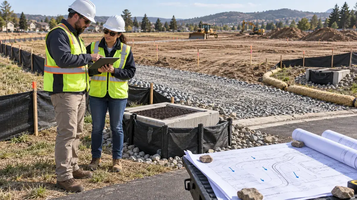
A project team preparing to clear, grade, excavate, or stockpile soil often asks a practical question before construction begins: what erosion and sediment control planning should be completed before land disturbance starts? The answer matters because sediment controls are not simply field details to add after equipment arrives. They affect permit readiness, plan review, contractor sequencing, inspection expectations, downstream drainage risk, neighboring properties, and the credibility of the project team when municipal staff, owners, or regulators ask how runoff will be managed during construction.
For municipalities, the issue is also bigger than a single site. Construction runoff can overload inlets, clog ditches, send sediment into storm sewer systems, and create complaints that public works staff must investigate. For developers and builders, poor early planning can lead to delayed mobilization, rejected submittals, repeated field corrections, and avoidable conflict between the civil plans, the SWPPP, and actual construction sequencing. For property owners and facility managers, the same planning gap can show up as muddy access points, unstable slopes, blocked drainage paths, or confusion about who is responsible for maintaining controls after each storm.
The best time to solve these problems is before disturbance begins. A useful erosion and sediment control plan connects the existing drainage pattern, proposed grading, receiving storm system, construction phasing, access routes, stockpile locations, dewatering assumptions, inspection responsibilities, and stabilization schedule. It should also make the field work buildable. Controls that look adequate on a plan sheet but cannot be installed, reached, inspected, or maintained during the first phase of work rarely perform as intended.
Who This Affects
This issue affects developers preparing civil submittals, contractors planning mobilization, municipal engineering reviewers, MS4 program managers, public works inspectors, private owners disturbing land for facility expansion, builders working under a common plan of development, and design professionals responsible for translating drainage intent into construction-phase controls.
It also affects projects that appear small at first glance. Under federal construction stormwater context, permit coverage is generally tied to construction activity disturbing one acre or more, or less than one acre when the activity is part of a larger common plan of development or sale that will ultimately disturb one or more acres. State, tribal, territorial, or local programs may have additional thresholds, local ordinance requirements, or more specific design details. That means teams should confirm the applicable permitting authority and local municipal expectations before assuming a site is too small to need formal erosion and sediment control planning.
Municipalities are directly affected because many regulated MS4 programs must address construction site runoff control as part of their stormwater management programs. Reviewers and inspectors need enough information to understand how sediment will be kept out of the public storm system, how controls will change as grading progresses, and who will maintain those controls. When the submittal is vague, the municipality may be left trying to enforce a plan that does not match the field sequence.
Developers and contractors are affected because erosion and sediment control planning often sits at the intersection of design, schedule, and money. A contractor may want to open a broad work area for efficiency, while the drainage plan may depend on phased stabilization and downgradient controls. A developer may want to begin clearing quickly, while the permit or local approval may require documentation, notices, inspections, or pre-construction meetings first. Aligning those expectations early can reduce avoidable starts and stops.
Property owners, HOAs, schools, industrial sites, and commercial campuses can face the same issue during parking lot expansions, utility work, pad preparation, drainage repairs, or redevelopment. Even when a project is not large, disturbed soil near inlets, channels, wetlands, detention basins, or neighboring lots can create visible runoff problems quickly. Good planning gives owners a clear record of what was intended, what was installed, and what needs to be maintained while the ground is exposed.
The Stormwater Planning Issue
The core planning issue is simple: disturbed soil moves with stormwater unless the site is sequenced, stabilized, and controlled. Once clearing and grading begin, runoff patterns can change within hours. Existing vegetation may be removed, compacted haul roads may concentrate flow, stockpiles may sit in drainage paths, and temporary slopes may drain toward inlets or property lines that were not vulnerable before construction. A plan that waits until the first rain event to solve those conditions is already behind.
EPA construction stormwater materials identify sediment and other pollutants from construction sites as common concerns, including debris, nutrients, oil and grease, concrete washout, construction chemicals, and construction debris. The federal construction stormwater framework also emphasizes erosion and sediment controls, pollution prevention measures, stabilization of disturbed areas, and controls for discharges such as dewatering and concrete washout. These are not merely paperwork concepts. They should shape how the site is opened, how the first controls are installed, how temporary drainage is routed, and how the contractor documents maintenance.
A frequent disconnect occurs when the erosion and sediment control sheet is treated as a static exhibit. Many projects need the opposite: a construction-phase drainage strategy that changes as work progresses. Early clearing may require perimeter controls, stabilized access, inlet protection, and stockpile placement. Mass grading may require sediment traps, diversion berms, temporary slope drains, check dams, or phased basin installation. Utility work may require trench dewatering controls, protection for downstream inlets, and rapid stabilization behind crews. Final paving and landscaping may require a transition from temporary controls to permanent stormwater features without leaving gaps.
Another issue is that erosion control and sediment control are related but not identical. Erosion control focuses on keeping soil in place through stabilization, cover, phasing, slope protection, vegetation, mulch, matting, and minimizing exposed area. Sediment control focuses on intercepting soil that has already moved through perimeter barriers, sediment basins, inlet protection, traps, socks, filter berms, or other devices. A plan that leans only on sediment control can become maintenance-heavy and fragile. A plan that prioritizes early stabilization and smaller exposed areas can often reduce the load on sediment controls.
Documentation can be just as important as design. If the plan does not identify drainage areas, receiving inlets, installation timing, inspection frequency, maintenance triggers, responsible parties, and stabilization milestones, field crews may make their own assumptions. Those assumptions might be reasonable in isolation but inconsistent across the site. The result can be missed controls, duplicated controls in the wrong places, or controls installed after sediment has already reached the storm sewer.
Local context matters. A flat urban infill lot draining to a curb inlet has different needs than a steep subdivision phase draining toward a creek. A redevelopment site with limited staging area has different risks than a greenfield site with room for temporary basins. A municipal roadway project with moving work zones has different inspection and stabilization challenges than a single private building pad. Good planning starts with the receiving system, slopes, soils, flow paths, and construction sequence rather than a generic checklist.
What To Review Before Moving Forward
Before land disturbance begins, the project team should review the items that determine whether the erosion and sediment control plan can actually work in the field.
- Disturbance limits: Confirm the exact area to be cleared, graded, excavated, filled, or used for temporary access and staging. Disturbance limits should include stockpiles, laydown areas, temporary haul routes, utility corridors, and any off-plan work that may expose soil.
- Permit pathway: Confirm whether construction stormwater permit coverage, local grading approval, municipal erosion control approval, pre-construction meetings, notices, or inspection documentation are required before work begins. For projects near the one-acre threshold, review whether the work is part of a common plan of development or sale.
- Existing drainage pattern: Identify where runoff currently leaves the site, which inlets or ditches receive flow, whether off-site runoff enters the property, and where temporary changes during construction could redirect water toward neighbors, roads, streams, wetlands, or storm sewer structures.
- Construction sequence: Review the order of clearing, demolition, grading, utility installation, building pad work, paving, landscaping, and final stabilization. Controls should be tied to the sequence, not just shown at the finished grading condition.
- Downgradient controls: Confirm that perimeter controls, inlet protection, stabilized exits, sediment traps, sediment basins, diversions, or other controls will be installed before the areas draining to them are disturbed. A control that is installed after clearing begins may miss the highest-risk period.
- Access and track-out: Review where vehicles will enter and leave, how construction entrances will be stabilized, how sediment will be kept off public streets, and who will respond when sweeping, aggregate replacement, or entrance repairs are needed.
- Stockpiles and materials: Identify where soil, aggregate, chemicals, fuels, forms, waste, and concrete washout will be located. Stockpiles should avoid drainage paths, inlets, steep slopes, property lines, and areas where maintenance access is poor.
- Dewatering assumptions: If excavations, trenches, foundations, or utility work may require dewatering, decide before mobilization how water will be filtered, settled, discharged, or otherwise managed under applicable requirements. Dewatering should not become a field improvisation during an emergency.
- Stabilization milestones: Define when temporary seed, mulch, erosion control blanket, pavement, aggregate cover, or final landscaping will be installed. Stabilization timing is one of the most practical ways to reduce sediment movement.
- Inspection responsibilities: Assign who will inspect controls, how findings will be documented, what conditions trigger maintenance, and how corrective actions will be communicated to the contractor, owner, engineer, and municipal inspector.
- Transition to permanent stormwater features: Review whether temporary controls protect, interfere with, or prematurely load permanent BMPs such as bioretention cells, detention basins, permeable pavement, swales, or proprietary treatment units. Permanent systems should not become sediment traps unless they are designed and managed for that construction-phase role.
- Plan-sheet clarity: Confirm that erosion and sediment control details, notes, drainage arrows, phase boundaries, control labels, maintenance notes, and responsible-party references are legible and consistent with the SWPPP or other construction stormwater documentation.
The review should happen with the people who will actually execute the work. Civil engineers, owners, site contractors, utility contractors, inspectors, and municipal reviewers may each see different risk points. A short pre-disturbance discussion can reveal conflicts that are hard to fix once equipment is on site.
Planning, Permitting, or Compliance Support That Fits
Stormwaterplanning.us can support teams that need construction-phase stormwater planning to be clearer before grading begins. That support may include reviewing drainage patterns, organizing erosion and sediment control considerations, helping prepare SWPPP-related documentation, coordinating construction stormwater permit readiness, reviewing municipal submittal expectations, or helping owners and project teams understand what should be documented before land disturbance.
For municipalities, support can focus on review consistency, construction runoff control checklists, MS4 program documentation, and practical inspection expectations. Many municipal staff members are balancing development review, public works operations, drainage complaints, and permit program responsibilities. A clearer framework for erosion and sediment control submittals can help reviewers ask better questions earlier and reduce avoidable field disputes later.
For developers and builders, support can focus on making the submittal more complete and buildable. That may include checking whether the erosion and sediment control plan aligns with phasing, verifying that drainage arrows and disturbance limits are understandable, identifying missing construction entrances or inlet protections, and helping the team organize responsibilities before the contractor mobilizes. This does not guarantee permit approval or eliminate regulator review, but it can make the planning package easier to evaluate and easier to use in the field.
For private owners and facilities, support can focus on documenting site conditions, proposed disturbance, runoff pathways, nearby inlets, receiving ditches, existing drainage complaints, and stabilization plans. Owners often need a practical bridge between the civil plan, the contractor’s means and methods, and the compliance documentation expected by the permitting authority. A well-organized planning process helps clarify that bridge before exposed soil creates visible problems.
The best support is usually specific. Instead of asking whether a project needs silt fence, the better question is where runoff goes during each phase, what is exposed, what must be protected first, and how the team will know when a control needs maintenance or replacement. That kind of planning is more useful than a generic list of BMPs because it reflects the actual site.
Common Mistakes to Avoid
One common mistake is starting clearing before downgradient controls are installed and functional. The first phase of disturbance can create the highest sediment risk because vegetation is removed before temporary drainage patterns are fully understood. If controls are installed only after the contractor sees where water runs, sediment may already have left the work area.
Another mistake is relying on a single perimeter control for every condition. Silt fence, wattles, filter socks, inlet protection, sediment traps, basins, check dams, and stabilized exits each have practical limits. The right control depends on slope, drainage area, flow concentration, soil type, available space, maintenance access, and downstream sensitivity. A plan that repeats one detail around the entire site may be easy to draw but hard to defend.
A third mistake is ignoring off-site runoff. Many sites receive water from adjacent streets, slopes, roofs, parking lots, or upstream undeveloped land. If that flow crosses disturbed soil, the construction site may receive more runoff than the project team expected. The plan should show how clean water is diverted around disturbance where practical, or how it will be managed without overwhelming sediment controls.
A fourth mistake is placing stockpiles where they block drainage or drain directly to inlets. Stockpiles need space, but they also need perimeter protection, cover or stabilization when appropriate, and access for maintenance. A stockpile location that works for hauling may fail from a stormwater perspective.
A fifth mistake is treating inlet protection as the only meaningful defense in urban work. Inlet protection can be important, but it should not be the first and only place where sediment is managed. If sediment reaches the inlet, it has already crossed the site or street. Urban projects often need stabilized entrances, street sweeping plans, perimeter controls, phased work areas, and rapid stabilization in addition to inlet protection.
A sixth mistake is overlooking concrete washout, fueling, waste, and material storage. Construction stormwater planning is not limited to soil. Pollutants from outdoor materials and construction activities can move with runoff if locations and procedures are not set before work begins.
A seventh mistake is failing to update the plan as construction changes. Field conditions change as utilities are installed, slopes are cut, basins are excavated, pavement is placed, and landscaping begins. The documentation should be able to track those changes so inspectors and contractors are working from the same assumptions.
An eighth mistake is allowing permanent stormwater BMPs to receive sediment too early. Bioretention media, permeable pavement, underground treatment units, and outlet structures can be damaged or clogged when they are used as construction-phase sediment controls without proper protection and restoration plans. The transition from temporary to permanent stormwater management should be deliberate.
Next Step
Before land disturbance begins, gather the civil plans, grading sequence, SWPPP or construction stormwater documentation, local permit conditions, and a simple drainage map showing where runoff will go during each phase of work. Then compare those documents against the actual mobilization plan. If the controls, access routes, stockpile areas, inspection duties, and stabilization milestones do not match the way the site will be built, resolve those gaps before clearing or grading starts.
The most useful question is not whether the plan has enough notes. The useful question is whether the first rain after disturbance will find a site that is already organized: exposed areas limited, downgradient controls installed, inlets protected, access stabilized, responsibilities assigned, and maintenance triggers understood. That is the point where erosion and sediment control planning moves from paperwork into practical stormwater risk reduction.