
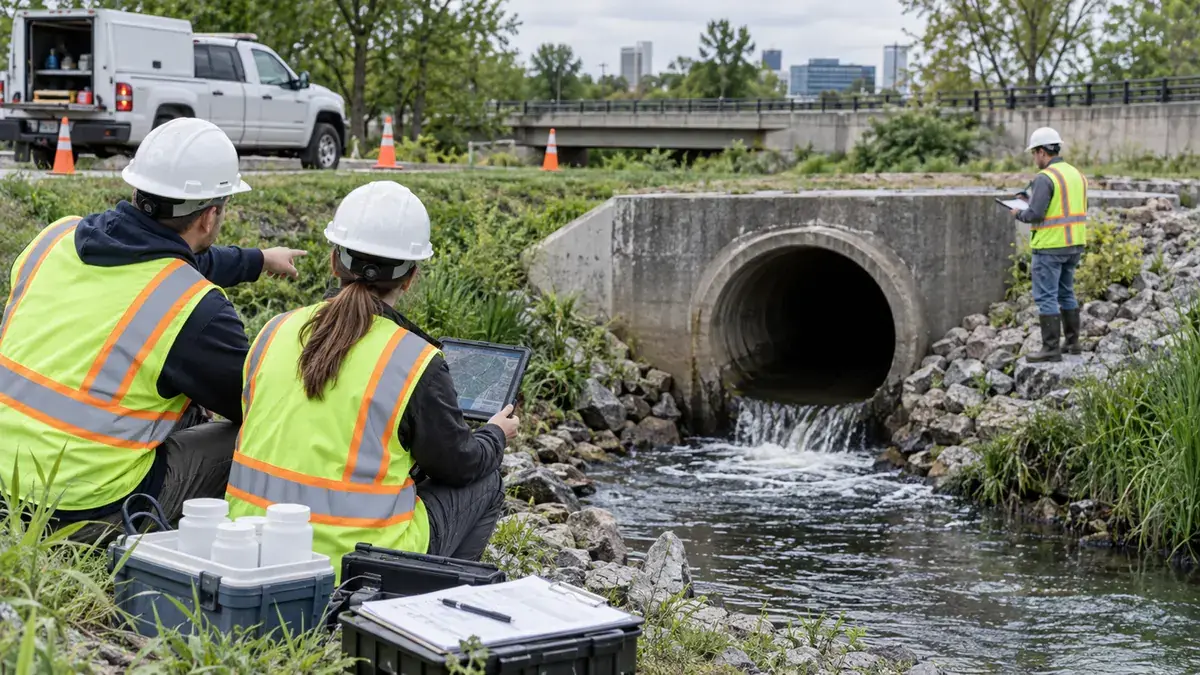
Municipal separate storm sewer system communities often know they need an illicit discharge detection and elimination program, but the practical question is usually more specific: what should be organized before staff, consultants, or seasonal crews begin outfall screening in the field?
That question matters because outfall screening is where permit language, storm drain mapping, field access, drainage complaints, water quality concerns, and public works capacity all meet. A community may have a stormwater management program on paper, but if the outfall list is incomplete, the inspection form is unclear, or dry-weather flow findings are not routed to a response process, the field work can become a collection of disconnected observations. The result is not always a failed program. More often, it is wasted field time, inconsistent documentation, unclear follow-up responsibilities, and data that cannot support confident decisions.
For municipalities, IDDE planning is also a public trust issue. Residents see storm drains, ditches, creeks, odors, staining, dumping, and unusual flows. Council members hear drainage and water quality complaints. Public works crews often know where suspicious conditions have appeared before, but those observations may not be in the same place as the GIS map, permit file, complaint log, or capital planning list. A well-organized outfall screening effort helps bring those pieces together before crews are standing at a pipe with limited time and imperfect site conditions.
For consultants and engineering teams supporting MS4 communities, the planning phase is where expectations should be made specific. Which outfalls will be screened this season? Which ones are major outfalls, priority outfalls, or difficult-access structures? What conditions trigger sampling, source tracing, reinspection, referral to code enforcement, or coordination with sanitary sewer staff? How will photographs, coordinates, flow observations, and field notes be named and stored? Those decisions sound administrative, but they shape the usefulness of the entire IDDE effort.
This article focuses on what MS4 communities should organize before field work begins. It does not replace permit-specific legal review, and it cannot promise compliance outcomes. It can, however, help public works directors, city engineers, planners, and environmental compliance staff prepare an IDDE screening program that is easier to implement, easier to document, and easier to defend during annual reporting, audits, and internal program reviews.
Who This Affects
Outfall screening and IDDE planning most directly affect regulated MS4 communities, including cities, towns, counties, drainage districts, transportation agencies, universities, and other public entities that own or operate storm drain systems subject to NPDES permit requirements. The exact permit conditions vary by state and permit type, but the need to detect and address illicit discharges is a common part of municipal stormwater program implementation.
Public works directors are often responsible for turning permit expectations into staffing, schedules, equipment purchases, and work orders. They need a process that fits real crew availability, seasonal weather, safe access, and competing maintenance demands. If the IDDE plan assumes unlimited field time or highly specialized sampling on every visit, it may look polished but fail during implementation.
City and county engineers need reliable drainage system information. Outfall screening can reveal mapping gaps, disconnected pipe assumptions, undersized conveyances, structural defects, erosion at discharge points, and field conditions that do not match older record drawings. Those observations can support asset management and capital planning when they are captured consistently.
Planning departments and development reviewers may also be affected. New subdivisions, redevelopment sites, commercial projects, and industrial users may connect to municipal storm drain infrastructure. When outfall information is weak, it becomes harder to evaluate downstream impacts, maintenance access, or whether private drainage features are connected to public systems in ways that need additional review.
Environmental compliance managers need documentation that can survive questions. Annual reports, program audits, and permit renewals often depend on records showing that the community had a method for identifying outfalls, prioritizing inspections, responding to suspect flows, and following up when needed. A folder of photos without location, date, weather, and decision notes rarely provides the same value.
Field inspectors and maintenance crews are affected because they carry the plan into the real world. They need clear definitions, practical forms, safe access instructions, and a simple way to flag conditions that require follow-up. They should not have to guess whether a trickle during dry weather is routine groundwater, irrigation return flow, chlorinated discharge, sewage, wash water, or something that needs escalation.
Developers, property owners, facility managers, HOAs, and industrial site operators can also be affected when source tracing leads upstream. A municipal IDDE investigation may involve private laterals, cross-connections, outdoor storage areas, dumpster pads, washdown practices, floor drains, or unknown pipes. A better planned municipal process can make those conversations more factual and less reactive.
The Stormwater Planning Issue
EPA describes MS4 stormwater management programs as programs intended to reduce pollutants discharged from municipal storm sewer systems, and IDDE is one of the program areas commonly included in that framework. EPA guidance also emphasizes that stormwater and certain authorized uncontaminated non-stormwater discharges are generally the only flows that should enter the storm drain system. In practical terms, outfall screening is one of the ways communities look for evidence that something else may be entering the system.
The planning issue is that outfall screening is often treated as a field task first and a program task second. A crew receives a map, visits outlets, checks boxes, takes photos, and returns with observations. That can be useful, but it may not answer the program questions that matter most: Are all known outfalls represented? Were inspections prioritized based on risk? Was dry-weather flow evaluated using a consistent method? Were unusual colors, odors, floatables, deposits, pipe staining, vegetation changes, or biological indicators recorded in a way that can be compared over time? Did the community define what happens after a suspect condition is found?
Without that structure, IDDE field work can become too dependent on individual judgment. One inspector may photograph every staining pattern. Another may ignore staining unless there is visible flow. One crew may sample any dry-weather discharge. Another may only sample when there is odor. One department may keep notes in a spreadsheet while another logs work orders in an asset system. None of these choices are inherently wrong, but inconsistency makes it difficult to show a systematic program.
Another issue is that storm drain maps are often incomplete. Older neighborhoods may have undocumented pipes, buried outlets, ditches that function as conveyances, private connections, historic culverts, or outfalls hidden by vegetation and sediment. Redevelopment can change drainage patterns. Utility projects can add or abandon structures. If the outfall inventory is stale, screening work may miss the very locations that need attention.
Access is a planning problem too. Some outfalls are behind fences, along steep banks, in channels with unstable slopes, near traffic, on private property, or within areas that require coordination with parks, railroads, utilities, or drainage easement holders. If access questions are not resolved before the field season, crews lose time, skip locations, or collect observations from unsafe or inconsistent vantage points.
Weather and timing also matter. IDDE screening often emphasizes dry-weather conditions because dry-weather flow can indicate non-stormwater sources. But a community must define what counts as dry weather for its process, considering local rainfall patterns, groundwater, irrigation, sump pumps, snowmelt in colder climates, and tidal or backwater effects where relevant. If inspections occur too soon after rainfall, staff may document stormwater recession rather than a potential illicit discharge. If they wait too long during drought, some intermittent sources may not be visible.
The final planning issue is follow-up. Finding a suspect condition is only useful if the community has a realistic route to act on it. That route may include reinspection, screening upstream structures, reviewing drainage maps, checking sanitary sewer proximity, contacting property owners, coordinating with industrial pretreatment or code enforcement staff, issuing notices under local ordinance, or referring information to another agency. If the process is undefined, findings can stall.
Good IDDE planning does not make every discharge easy to explain. It does make the program more organized, repeatable, and useful. It helps communities decide where to go, what to record, how to interpret conditions, and when to take the next step.
What To Review Before Moving Forward
Before scheduling outfall screening field work, MS4 communities should review both the permit expectations and the practical operating details. The goal is not to create a binder that nobody uses. The goal is to give field staff and program managers a shared playbook.
- Confirm the current permit language. Review the community's MS4 permit, stormwater management program commitments, annual reporting requirements, and any state-specific IDDE guidance. Note required inspection frequencies, priority areas, recordkeeping expectations, and follow-up deadlines if they apply.
- Update the outfall inventory. Compare the GIS layer, as-built drawings, prior screening forms, drainage complaint locations, capital project records, maintenance crew knowledge, and aerial imagery. Flag outfalls that need field verification, coordinate correction, ownership review, or duplicate cleanup.
- Separate outfalls from other structures. Catch basins, manholes, culverts, ditch crossings, and private discharge points may all matter, but they are not always the same as regulated MS4 outfalls. Define categories clearly so the screening list is meaningful.
- Prioritize locations. Consider drainage area, land use, known hotspots, industrial or commercial areas, sanitary sewer proximity, older infrastructure, prior complaints, impaired waters, sensitive receiving waters, and previous suspicious observations. A priority framework helps explain why some locations are visited first.
- Define dry-weather screening conditions. Establish how many hours or days after rainfall staff should wait, how rainfall data will be checked, and how exceptions will be documented. The process should be practical enough for staff to apply consistently.
- Standardize field observations. Forms should capture date, time, inspector, weather, recent rainfall, coordinates, receiving water, pipe material and size if visible, flow presence, color, odor, turbidity, floatables, deposits, staining, vegetation condition, erosion, structural concerns, photos, and recommended follow-up.
- Decide when sampling is appropriate. Not every observation requires sampling, and not every community has the same equipment or laboratory access. Define screening parameters, field test kits, sample handling expectations, and escalation triggers before crews are in the field.
- Plan for safety and access. Identify outfalls requiring traffic control, confined space avoidance, steep bank precautions, boat or wader restrictions, private property coordination, vegetation clearing, or two-person field teams. Safety constraints should be part of the schedule, not an afterthought.
- Set photo and file naming rules. Photos should connect to the outfall ID, date, direction, and observation. A simple naming convention can prevent hours of confusion when preparing annual reports or reviewing multi-year trends.
- Connect findings to work orders. If the community uses an asset management system, decide whether IDDE findings create work orders, inspection records, compliance tasks, or separate environmental follow-up records. The pathway should be clear.
- Assign response responsibilities. Determine who reviews field results, who authorizes reinspection or source tracing, who contacts property owners, who coordinates with sanitary sewer staff, and who updates permit records.
- Build a closeout step. Each suspect finding should eventually have a documented status, such as resolved, referred, monitored, inconclusive, corrected by maintenance, corrected by owner, or scheduled for additional investigation. Open-ended findings weaken program accountability.
This review does not need to stop field work for months. Many communities can improve their IDDE program by tightening the outfall list, revising the form, confirming rainfall criteria, and agreeing on follow-up routing before the next inspection cycle begins.
Planning, Permitting, or Compliance Support That Fits
Stormwater Planning can support MS4 communities, public works departments, engineering teams, and local governments that need a more organized approach to outfall screening and IDDE documentation. The most useful support usually begins with the system the community already has, not a generic template.
For communities with existing maps and prior inspection records, support may include reviewing the outfall inventory, identifying missing attributes, cleaning up duplicate or unclear locations, and preparing a practical screening list for the next field season. This can help staff focus on the outfalls most likely to matter for water quality, permit documentation, or drainage system understanding.
For communities preparing for an MS4 program review or annual report, support may include organizing IDDE records, checking whether follow-up actions are documented, summarizing screening progress, and identifying gaps that should be addressed in the next permit year. The goal is to support compliance planning and improve record clarity, not to promise regulatory acceptance.
For municipalities with limited staff capacity, Stormwater Planning can help develop inspection forms, prioritization criteria, field maps, photo naming conventions, and internal procedures that make the field effort easier to repeat. A concise workflow can be more valuable than a long manual if it matches how the department actually operates.
For engineering and consulting teams, support may include integrating IDDE screening priorities with storm drain GIS updates, drainage studies, capital improvement planning, maintenance planning, and public complaint tracking. Outfall screening data often has value beyond the permit file when it is collected in a structured way.
For developers, owners, and facility managers who become involved during source tracing or drainage review, Stormwater Planning can help clarify what information should be assembled before discussions with the municipality. That may include site drainage plans, utility records, outdoor operations descriptions, maintenance logs, previous inspection reports, and documentation of corrective actions.
IDDE work is most effective when it is treated as part of a broader stormwater management system. The field visit is important, but the value comes from the preparation before it and the decisions after it. A good process helps communities move from isolated observations to organized action.
Common Mistakes to Avoid
One common mistake is starting with an outdated outfall map. If the map does not reflect recent development, drainage repairs, annexations, or older undocumented infrastructure, the screening effort may miss key discharge points. Even a limited pre-field map review can catch obvious problems before crews mobilize.
Another mistake is using the same priority for every outfall. Equal treatment sounds fair, but it may not be strategic. Outfalls draining older commercial corridors, industrial areas, dense neighborhoods, sanitary sewer conflict zones, or sensitive receiving waters may deserve earlier or more frequent attention than low-risk locations with no history of concern.
A third mistake is failing to define dry-weather conditions. If one inspection occurs six hours after rain and another occurs five dry days later, the observations may not be comparable. Communities should document the rainfall window used for screening and note exceptions when field schedules require flexibility.
Some communities collect too little information. A check mark that says "OK" may not explain what was observed, where the inspector stood, whether flow was present, or why no follow-up was needed. Concise forms are good, but they still need enough detail to support later review.
Other communities collect too much information without a decision process. Long forms can produce large datasets that nobody evaluates. If staff record twenty observations but the program does not define what triggers action, the extra detail may not improve outcomes. The best forms connect observations to decisions.
Photo management is another frequent problem. Photos without outfall IDs, dates, or directions can become nearly useless after a field season. A simple convention, such as outfall ID plus date plus view direction, can make records easier to interpret.
Communities also sometimes overlook maintenance observations. Erosion, sediment blockage, damaged end sections, vegetation obstruction, or unstable banks may not prove an illicit discharge, but they can affect access, drainage function, and future screening. Capturing these notes can help public works coordinate maintenance and inspections.
Another mistake is treating source tracing as purely environmental. Suspect discharges may involve sanitary sewer staff, code enforcement, building officials, industrial pretreatment programs, health departments, property owners, or neighboring jurisdictions. Planning those coordination paths ahead of time can reduce confusion.
Some programs rely too heavily on one staff member's institutional knowledge. Experienced employees are invaluable, but the program becomes fragile if outfall locations, past findings, and follow-up logic live mostly in memory. Written procedures and organized records help preserve continuity through staff turnover.
Finally, communities sometimes close findings informally. A phone call, field conversation, or maintenance visit may resolve an issue, but if the record is never updated, the program may still appear incomplete. IDDE planning should include a habit of closing the loop.
Next Step
Before the next outfall screening season, choose a small set of program elements to tighten: the outfall inventory, priority criteria, dry-weather definition, field form, photo naming rules, and follow-up responsibilities. Those six items can turn IDDE field work from a checklist exercise into a practical stormwater management tool.
For municipalities, the immediate next step is to compare the current outfall list against the latest GIS data, maintenance knowledge, complaint history, and permit commitments. For consultants, it is to confirm with the client how findings will be reviewed and closed. For property owners and facility managers, it is to keep drainage and outdoor operation records organized in case municipal source tracing raises questions.
Outfall screening does not have to be complicated to be useful. It does need to be organized. A community that knows where its outfalls are, why certain locations are priorities, what field staff should document, and how suspect findings will be handled is in a stronger position to support compliance planning, protect receiving waters, and make better infrastructure decisions over time.
Sources
- U.S. Environmental Protection Agency, Stormwater Discharges from Municipal Sources: Developing an MS4 Program
- U.S. Environmental Protection Agency, National Menu of Best Management Practices for Stormwater: Illicit Discharge Detection and Elimination
- U.S. Environmental Protection Agency, NPDES Stormwater Program