
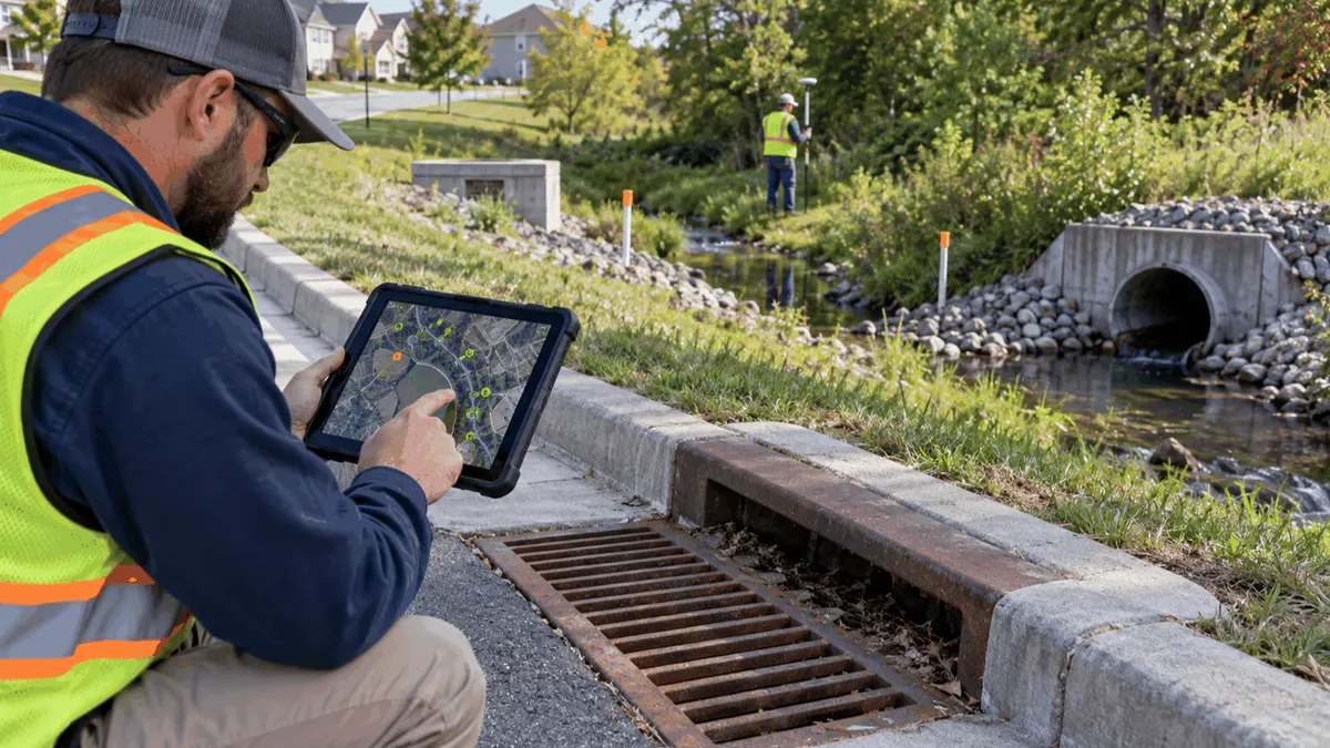
Stormwater maps become more useful when public works teams define shared attributes, ownership, evidence, and update rules before field collection begins.
A stormwater map can show thousands of points and lines while still failing the people who need it. A catch basin may have a location but no condition, an outfall may have a photo but no receiving water, and a pipe may be drawn without knowing whether the geometry came from a record drawing, survey, or field estimate. These gaps slow maintenance, complicate plan review, and make it harder to explain how drainage decisions were made.
Attribute standards give a mapping project a common language. They help staff capture the same kinds of information for each asset, distinguish observed facts from assumptions, and identify what needs verification. This article focuses on planning and documentation. It does not promise a permit, grant, approval, or compliance outcome, and local requirements and permit terms should guide the final program.
Who This Affects
Public works departments use asset attributes to schedule inspections, respond to flooding complaints, plan cleaning, and prioritize capital work. Engineering and GIS teams use them to connect survey data, drainage models, easements, parcels, receiving waters, and project records. Emergency managers may need the same information to understand blocked routes or vulnerable facilities. Contractors and consultants need clear definitions so that delivered data can be accepted without a long cycle of corrections.
Developers and property owners may also need to provide stormwater infrastructure information during design review or handoff. A private facility can affect a public drainage network even when the city does not own it. Defining ownership, access, maintenance responsibility, and source documentation early helps avoid the common situation in which an asset appears on a map but no one knows who can inspect it.
A stormwater program may also use the map for MS4 planning, IDDE work, outfall screening, BMP maintenance, or SWPPP coordination. EPA materials describe the value of maps that connect outfalls, drainage infrastructure, receiving waters, treatment facilities, watersheds, critical land uses, and potential pollutant sources. The exact fields should be adapted to the community's system and permit context.
The Stormwater Planning Issue
The central issue is not choosing a particular software platform. It is deciding what information must stay consistent when data moves between field forms, GIS, work orders, inspection logs, capital plans, and annual reporting. If one team calls an asset “inactive” and another calls it “abandoned,” a query can miss it. If a field is optional for one contractor and mandatory for another, the resulting map may look complete while hiding uneven confidence.
Start with an asset dictionary. Define asset types such as inlet, manhole, pipe, ditch, culvert, outfall, detention facility, treatment BMP, pump, access point, and receiving-water connection. For each type, define the identifier, geometry, ownership, maintenance responsibility, operational status, condition, inspection date, data source, confidence, photo reference, and next action. Keep the first version practical. A field that no one can collect or maintain is not a useful standard.
Separate attributes that describe the asset from attributes that describe the observation. The pipe's material and diameter may come from a record drawing, while its sediment level and blockage status come from a field inspection. A condition rating should carry an inspection date and method. A location confidence field can distinguish surveyed coordinates from digitized estimates. This separation helps staff update observations without rewriting the asset history.
Define the Minimum Useful Record
Every asset should have a stable identifier that survives a software migration, contractor change, or map redesign. The identifier should not depend only on a street address, because one address can contain multiple inlets, pipes, or private connections. A related-asset field can connect an inlet to a pipe, a pipe to an outfall, or an outfall to a receiving water without collapsing those distinct objects into one record.
Use controlled values for ownership, status, condition, inspection method, and data confidence. A short list is easier to train and analyze than free text. Include an “unknown” or “needs verification” value where appropriate, rather than forcing staff to guess. Unknown is a useful project-management signal when it leads to a defined follow-up.
Document the source and date for each important field. A record drawing, survey, work order, inspection, aerial image, complaint, and model result do not carry the same level of certainty. A source field does not guarantee accuracy, but it tells the next reviewer what to check. For high-priority assets, keep a link or reference to the underlying evidence in the approved record system.
What to Review Before Moving Forward
Review existing layers before commissioning new field collection. Compare the storm sewer map with as-builts, drainage studies, street inventories, easements, outfall lists, maintenance routes, flood complaints, and prior inspection photos. Look for duplicate features, disconnected networks, inconsistent coordinate systems, and assets that appear in one department's file but not another's.
Then define the update workflow. Decide who creates an asset, who approves a change, who can retire a feature, and how corrections are documented. A field crew should be able to report a missing inlet without editing the authoritative layer directly if that is how the organization controls data. The workflow should record the old value, new value, date, source, and reviewer for changes that affect decisions.
Field forms should match the dictionary. Avoid asking crews to collect information that the office will not use, but do not omit the observations needed for maintenance or IDDE prioritization. Include required photographs where visual evidence matters, with a consistent view of the inlet, outfall, condition, and surrounding area. Note when an asset was inaccessible, submerged, unsafe to approach, or obscured by vegetation.
Quality assurance should be planned as a sample, not left to the end. Review a set of field records for location accuracy, required attributes, photo linkage, duplicate identifiers, and plausible relationships. Test whether a supervisor can find all assets needing cleaning, all outfalls without a recent screen, or all facilities with unknown ownership. If the map cannot answer the question, revise the standard or the collection process before expanding the project.
Planning, Permitting, or Compliance Support That Fits
Attribute standards can support compliance planning by making responsibilities and evidence easier to find. For an MS4 program, a connected map can help organize outfalls, receiving waters, drainage areas, screening history, and IDDE follow-up. For construction, the same discipline can connect site features, BMP locations, inspection dates, corrective actions, and closeout information. The map supports documentation; it does not replace the permit, SWPPP, inspection, or professional judgment.
Engineering teams can use consistent attributes to scope surveys and models. Before modeling begins, they can identify which pipes lack invert data, which structures have uncertain connectivity, and which catchments need boundary review. That can reduce rework and clarify what a project budget actually covers. It can also help explain why a model result is preliminary when the input network contains estimated or unverified features.
Capital planners can connect condition, consequence, maintenance history, complaint patterns, and project status without pretending that one score decides the answer. A transparent prioritization method can show which assumptions matter and where more field evidence would change the order. The result is a defensible planning conversation, not a promise of funding or approval.
Training should cover both GIS mechanics and operational meaning. Field crews need to know why an identifier, photo angle, or access note matters. GIS staff need to know how maintenance teams use the data. Managers need to know how missing evidence affects a decision. Short exercises using a real drainage segment can reveal whether the dictionary is understandable across departments.
Common Mistakes to Avoid
One mistake is beginning with a beautiful map instead of a useful data model. Styling can hide missing ownership, uncertain connectivity, or stale inspection dates. Define the questions first, then choose the fields and map views that answer them.
Another mistake is treating every source as equally reliable. Record drawings can contain errors, field observations can be limited by access, and aerial images can hide underground connections. Preserve source and confidence so users do not mistake an estimate for a survey.
Do not create dozens of mandatory attributes without a maintenance plan. Staff may respond by entering placeholders, copying old values, or skipping the system. A smaller set of well-defined fields with a clear update owner usually produces better information over time.
Finally, do not let GIS become a silo. A map that is not connected to work orders, inspection records, project closeout, or public-works routines will age quickly. Assign stewardship, schedule review, and make the map part of the decisions it is intended to support.
Next Step
Choose one drainage area and hold a short attribute workshop with GIS, public works, engineering, and maintenance staff. Write down the minimum record for each asset type, controlled values, source rules, and the owner of each update. Test the draft on a small field sample before scaling the collection. This creates a practical baseline for future mapping, review, inspections, and capital planning.
Sources U.S. EPA, Developing an MS4 Program, https://www.epa.gov/npdes/stormwater-discharges-municipal-sources-developing-ms4-program; U.S. EPA, MS4 Program Evaluation Guidance, https://www3.epa.gov/npdes/pubs/ms4guide_withappendixa.pdf; U.S. EPA, Stormwater Phase II Illicit Discharge Detection and Elimination, https://www.epa.gov/npdes/national-menu-best-management-practices-bmps-stormwater-illicit-discharge-detection-and