
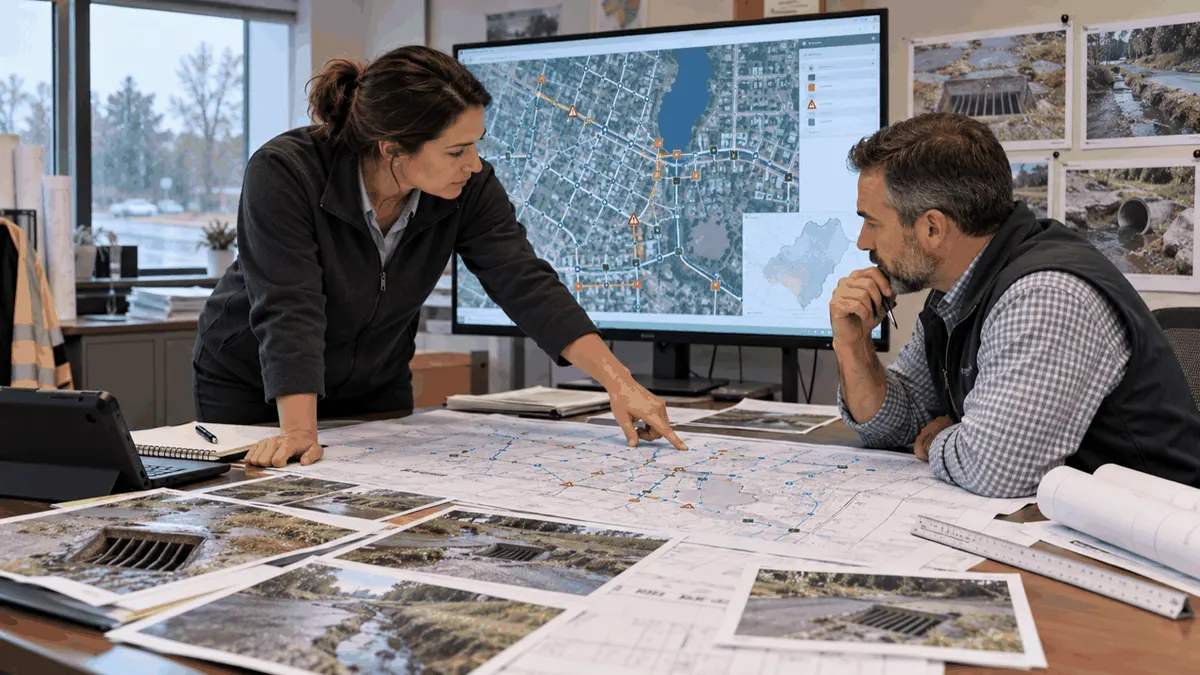
Stormwater utility capital planning helps cities connect drainage complaints, mapped assets, field evidence, project benefits, and long-term maintenance needs.
Municipal stormwater teams rarely have enough money or staff to address every flooding complaint, failing inlet, undersized culvert, aging outfall, and maintenance backlog at once. A capital plan gives decision makers a way to compare needs over time. It should not be a list of the loudest complaints. It should show how each proposed project relates to an asset, a service problem, a risk, a regulatory responsibility, a feasible funding path, and the people who will maintain the result.
The planning process is useful for cities, counties, public works departments, utilities, developers contributing improvements, and engineering firms supporting a program. It also helps explain why a complaint may need inspection, maintenance, survey, modeling, easement work, or a capital project rather than an immediate construction response.
Who This Affects
Public works directors and stormwater managers use capital plans to set priorities and communicate tradeoffs. Engineers and GIS staff maintain the information that makes those priorities defensible. Finance staff need project scopes, timing, cost assumptions, and possible funding sources. Planning and development reviewers need to understand how private projects interact with public drainage systems.
Residents, businesses, HOAs, and facility owners may report localized flooding or erosion. Their observations are valuable, but the reported location may not be the source of the problem. A blocked inlet, downstream restriction, private connection, overland flow path, or maintenance issue may sit several blocks away. A planning workflow should preserve the complaint while testing the system around it.
Construction managers and developers also benefit from clarity. A map showing known constraints, outfalls, easements, and planned projects can reduce late redesigns. It does not guarantee approval or eliminate the need for site-specific engineering and local review.
The Stormwater Planning Issue
Capital planning begins with a reliable inventory. The inventory may include inlets, manholes, pipes, channels, culverts, detention facilities, outfalls, green infrastructure, pumps, easements, and known overland flow routes. Each asset should have a location, type, condition, ownership or responsibility, inspection history, and confidence level for the data.
Complaints can then be linked to the system. A complaint record should capture date, location, reported trigger, photographs, duration, affected property or road, weather if known, and prior response. The record should distinguish observed flooding from inferred causes. Repeated reports may indicate a chronic problem, while a single report after an unusual storm may point to a different investigation need.
Field evidence is the bridge between the inventory and the project list. Staff can check blockage, sediment, vegetation, inlet condition, pipe access, erosion, private connections, maintenance history, and signs of surcharge. Photos should include context, orientation, location, and date. A field note that says only "bad inlet" is difficult to compare with a note that identifies grate condition, sediment depth, nearby grade, and downstream observations.
The team should also record what happened after the field visit. Was the inlet cleaned, was a damaged grate replaced, did the next storm confirm the complaint, or is a survey still needed? Closing the loop makes the database useful for future capital decisions. It also helps staff explain to residents why a response was maintenance, monitoring, design, or a larger project rather than an immediate reconstruction.
Where a problem crosses organizational boundaries, the record should show the handoff. A public inlet may connect to a private drainage easement. A private development may discharge to a municipal outfall. A county road may cross a city system. Capital planning becomes harder when ownership is assumed instead of documented. A clear responsibility field lets the city identify coordination work before placing a project in a budget.
Projects should be described by the problem they address and the decision they enable. Examples include cleaning and repair, survey, easement acquisition, pipe replacement, culvert improvements, detention retrofit, green infrastructure, floodplain coordination, outfall stabilization, or a larger drainage study. The plan should state what is known, what is uncertain, and what work must happen before design.
Regulatory context should be handled carefully. EPA's NPDES stormwater program includes municipal separate storm sewer systems, construction activities, and industrial activities, but program details and permitting authority vary by jurisdiction. A capital plan can support documentation, water-quality goals, asset maintenance, and permit-program work. It should not promise regulatory acceptance or treat a planning list as a permit determination.
What to Review Before Moving Forward
Cities can use a repeatable framework for each candidate priority:
- Is the reported location mapped to the correct drainage system and responsible party?
- What evidence confirms the problem, and what remains an assumption?
- Is the issue maintenance, inspection, survey, modeling, design, construction, or a combination?
- Which people, roads, facilities, waterways, and critical services could be affected?
- Does the asset have a known condition, capacity, ownership, access, and maintenance history?
- Are private property, easement, railroad, utility, floodplain, or environmental constraints known?
- Would a small upstream or downstream action address the problem more effectively?
- What level of engineering analysis is appropriate before a cost estimate is used?
- Who will maintain the proposed improvement after construction?
- What funding, procurement, public communication, and schedule assumptions should be recorded?
Prioritization should be transparent. A city might score service impact, safety, water quality, recurrence, asset condition, consequence of failure, equity considerations, readiness, and cost. A score is a decision aid, not a substitute for professional judgment. Staff should record why a lower-scoring project moved ahead because of an emergency, grant timing, coordination opportunity, or public project.
The planning horizon should include more than the next budget year. Some actions are immediate maintenance, some are one-to-three-year investigations or designs, and some are long-term capital improvements. A phased list helps a city reserve survey funds, coordinate with roadway or utility work, communicate with affected owners, and avoid presenting an unfunded wish list as a committed project. It also creates a place to revisit assumptions when rainfall patterns, development, asset condition, or permit obligations change.
Data quality deserves a place in the plan. Unknown pipe size, uncertain invert elevation, missing ownership, or an unverified outfall can change the cost and feasibility of a project. Marking uncertainty honestly helps the team fund the right investigation instead of presenting a precise-looking but unreliable project list.
Maintenance should be planned alongside construction. A new inlet, pond, bioswale, or control structure has inspection, access, vegetation, sediment, and recordkeeping needs. The capital plan should identify who owns the asset, who receives complaints, who performs routine checks, and what triggers corrective work. Otherwise a project can solve one problem while creating an unfunded maintenance obligation.
Planning, Permitting, or Compliance Support That Fits
Stormwaterplanning.us can support municipalities and development teams with inventory organization, drainage studies, SWPPP planning, MS4 documentation, asset mapping, inspection workflows, BMP selection, and capital planning support. The appropriate service depends on whether the immediate need is information, design, documentation, program review, or project prioritization.
A city preparing a budget may need a condition and complaint database, field inspection protocol, project ranking framework, and concise public-facing explanation. A developer may need to understand existing drainage infrastructure, downstream constraints, and the documentation expected for a civil plan submittal. An industrial operator may need asset and maintenance records connected to stormwater compliance responsibilities.
Support should produce usable outputs: a map, table, decision log, inspection form, scope, prioritized list, or next-step memo. It should also identify assumptions and follow-up questions. No consultant or training course can guarantee permit approval, grant funding, or regulatory acceptance.
Common Mistakes to Avoid
One common mistake is building a capital list from complaints alone. Another is ranking projects by visible size without checking downstream consequences or maintenance history. Teams may also estimate construction costs before confirming access, easements, utilities, survey needs, or property responsibilities.
A map can create false confidence when old data is presented without a confidence field. A photo can also mislead when it has no location or date. Another mistake is treating a study as the project itself. A drainage study can clarify options, but the plan should state what decision follows the study and how the information will be used.
The final plan should be understandable to elected officials and residents as well as technical staff. Clear problem statements, maps, photos, assumptions, and next actions make the reasoning easier to review and update.
Finally, cities should avoid promising that one improvement will eliminate flooding everywhere. Stormwater systems have interacting constraints, and performance depends on rainfall, maintenance, upstream development, downstream conditions, and the selected design basis.
Next Step
Choose ten recent drainage complaints and connect each one to the mapped assets, field evidence, responsible party, and next decision. The gaps in that sample will show whether the city needs better mapping, inspection, maintenance records, modeling, project scopes, or public communication before building the next capital program.