
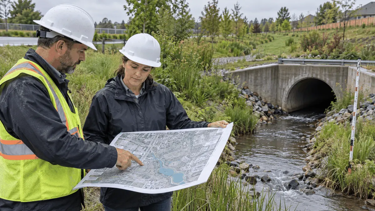
Clarifying stormwater outfall ownership before failure helps teams coordinate inspection, maintenance, documentation, and water-quality response.
An outfall may look like a simple pipe, headwall, swale, ditch, or culvert outlet, but its condition can depend on several parties. A municipality may own the public right of way, a developer may own a private drainage facility, a homeowners association may maintain a pond, and a property owner may control the land where the discharge emerges. Easements, recorded maintenance agreements, permit conditions, construction plans, and local program rules can all affect the answer.
When responsibility is unclear, routine work becomes reactive. Vegetation grows over an outlet, sediment blocks a channel, erosion advances below a pipe, an access route disappears, or a resident reports standing water. Staff then spend time searching for records instead of evaluating the problem. Stormwater planning can reduce that delay by connecting the asset, responsible party, inspection duty, maintenance standard, access route, and documentation in one usable record.
Who This Affects
Municipal public works departments and MS4 program teams often manage large networks of inlets, pipes, channels, culverts, detention facilities, and outfalls. They may inspect assets directly, coordinate with contractors, respond to complaints, or review private development obligations. City and county engineers need reliable information when planning rehabilitation, capital projects, or flood mitigation.
Developers and builders need to understand how a proposed drainage system will be operated after construction. Property owners, facility managers, and HOAs may become responsible for private ponds, swales, separators, or outfalls. Civil engineering firms and land development teams can help define the responsibility in plans and supporting documents, but ownership and maintenance should be confirmed with the applicable jurisdiction and recorded instruments.
Industrial operators may have additional inspection, good housekeeping, or stormwater documentation duties depending on their permit and operations. A property with an outfall near loading, material storage, vehicle maintenance, or waste handling needs a clear way to connect the discharge point to the site controls and inspection records.
The Stormwater Planning Issue
Ownership and maintenance are related but not always identical. A municipality may own a public pipe while a private party maintains a detention pond that feeds it. An easement may allow access without transferring ownership. A development agreement may assign inspection to an HOA while the city retains authority to review or enforce local requirements. A plan set may show an asset without explaining who will fund repair after acceptance or turnover.
Stormwater programs also use different terms for similar features. One record may call a location an outfall, another may call it a discharge point, and a third may identify the downstream structure. Without a stable identifier and map location, staff can mistake two nearby assets for one or fail to connect a complaint to the right drainage area.
The planning issue becomes more important when responsibilities cross a parcel boundary. A private outfall can discharge into a public ditch. A public culvert can receive runoff from a private site. A regional pond can serve multiple lots. Maintenance work may require permission, traffic control, environmental precautions, or coordination with a utility. The responsible party needs more than a name on a spreadsheet. It needs enough information to access, inspect, maintain, and document the asset.
Regulatory context should be handled carefully. MS4, construction stormwater, industrial stormwater, and local drainage requirements can overlap, but the applicable obligations depend on the jurisdiction, permit coverage, land use, ownership, and activity. Planning records can support compliance work, but they do not guarantee permit approval or regulatory acceptance. Teams should verify current requirements with the relevant authority and their qualified professionals.
A useful ownership record links the outfall to its upstream drainage area, downstream receiving feature, parcel, easement, design plans, maintenance agreement, inspection frequency, responsible organization, contact, access route, and escalation path. It should also identify uncertainty. An honest unknown is more useful than an incorrect owner that causes a work order to go to the wrong party.
What to Review Before Moving Forward
Municipalities and developers can use a shared review before a project is accepted, a facility changes hands, or a recurring maintenance problem is assigned.
- Locate the outfall with coordinates, a map reference, photographs, and a stable asset ID.
- Identify the upstream drainage area and the downstream channel, pipe, ditch, wetland, or receiving water.
- Compare as-built plans, approved civil plans, plats, easements, maintenance agreements, and turnover documents.
- Separate ownership, inspection responsibility, routine maintenance, emergency response, and capital repair responsibility.
- Confirm whether access is public, private, shared, gated, seasonal, or dependent on another property.
- Identify the inspection method and the conditions that require a work order, notification, or escalation.
- Record the feature type, pipe size if known, headwall or end treatment, erosion protection, vegetation, sediment, and visible defects.
- Note utilities, traffic, steep slopes, water depth, unstable ground, or other hazards that affect field work.
- Establish who receives photographs, inspection forms, complaints, and notices and where the records are stored.
- Set a review date for ownership changes, redevelopment, annexation, new maintenance agreements, or asset rehabilitation.
The review should include a field check when records conflict. A map may show a discharge point that is buried, relocated, or no longer connected to the system. A photograph may show an outlet that has been extended or altered. Field verification does not replace record research, but it helps the team understand what exists now.
Inspection records should be designed for decisions. A form can capture date, weather, flow, access, condition, obstruction, erosion, illicit discharge indicators, photographs, action needed, responsible party, due date, and completion evidence. For MS4 or industrial programs, the form should be aligned with the relevant permit and written procedures. For private systems, the owner should retain records according to its agreements and applicable requirements.
Complaint workflows benefit from the same clarity. When a resident reports flooding, odor, sediment, or a damaged outlet, the intake record should capture location, date, observed condition, recent rain, photographs, and whether the issue appears to involve a public asset, private facility, or shared system. Staff can then route the concern without promising a particular result before the field review.
Turnover is a key checkpoint. Before a municipality accepts a facility or a developer transfers a private system, the parties should verify that drawings, access rights, maintenance tasks, warranties, inspection expectations, and contact information are complete. A training session or handoff meeting can walk through the map and assets so the people who will operate the system understand the documents.
Planning, Permitting, or Compliance Support That Fits
Stormwater planning support is useful when an organization has maps and documents but cannot turn them into a dependable maintenance program. A focused review can reconcile asset records, identify missing ownership information, organize inspection fields, and create a practical handoff package. It can also help a municipality prioritize assets by condition, consequence, access, complaint history, or water-quality concern.
For developers, support may focus on submittal readiness and long-term operations. The goal is to make the drainage design understandable after construction, including who maintains each private facility and how the responsibility is documented. Clear records can reduce review delays and future disputes, but they do not promise approval or eliminate the need for jurisdiction-specific review.
For public works and MS4 teams, a program review can connect outfall mapping, inspection planning, IDDE response, complaint tracking, maintenance work orders, and capital planning. The team can then see where a field observation should create a routine task, an investigation, a repair project, or a request for ownership clarification.
Training should be assigned to the people who will use the system. Field staff need consistent inspection and safety procedures. Supervisors need to review evidence and prioritize work. Developers and property managers need to understand the documents they must retain and the maintenance responsibilities they accept. A certificate of completion can document participation, but the organization still needs current records and competent decisions.
Common Mistakes to Avoid
The most common mistake is assuming that the party shown on a map is automatically responsible for every task. Maps are valuable, but they do not replace deeds, easements, agreements, permits, or current field information.
Another mistake is recording only the owner and omitting access. An owner who cannot safely reach an outlet cannot perform routine inspection. Access rights, gates, vegetation, seasonal water, and traffic conditions should be part of the maintenance plan.
Some teams collect photographs without a stable asset ID or date. That makes it difficult to compare conditions over time. Standardized filenames, map references, and consistent inspection fields can make the record more useful.
Finally, organizations may wait for a failure before clarifying the handoff. Responsibility should be reviewed during design, construction, acceptance, redevelopment, property transfer, and changes to the stormwater program. Early clarity is usually easier than reconstructing decisions after a complaint or flood.
Next Step
Choose one drainage area with recurring complaints, aging outfalls, or unclear maintenance history. Trace each discharge point from the upstream system to the receiving feature, then compare the map with the agreements and the field condition. Mark what is confirmed, what is disputed, and what is missing.
That small review can become a repeatable workflow for a larger inventory. Clear ownership records help municipalities, developers, property owners, and compliance teams decide who should inspect, who should maintain, what should be documented, and when a stormwater planning question needs engineering or regulatory review.