
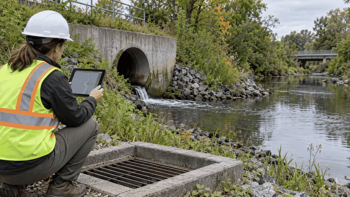
Before final stabilization, teams should connect field inspections, BMP changes, drainage assets, and closeout records in one reviewable package.
Who This Affects
Closeout documentation affects owners, developers, civil engineers, contractors, inspectors, public works staff, and municipal reviewers. Each group may hold a different part of the project story. The contractor knows what was installed and changed. The engineer understands the design intent. The inspector sees field conditions. The owner needs a usable maintenance record. A closeout review brings those perspectives together without assuming that one person's notes answer every question.
Final stabilization is more than a last photograph. It is the point at which the team can show what was completed, what remains active, where stormwater flows, which temporary controls were removed, and who will maintain permanent features. The exact permit and local requirements vary, so teams should compare the package with the applicable authorization and jurisdictional checklist.
The Stormwater Planning Issue
During construction, grades, inlets, swales, detention areas, outfalls, and access routes can change. A temporary berm may redirect water while a permanent curb opening is being built. A sediment basin may be converted to a permanent pond. A stabilized entrance may be removed after nearby soil is covered. If those transitions are not recorded, the closeout package can leave reviewers and future maintenance staff guessing about what exists.
Good records support compliance planning and can help prepare documentation for review. They do not promise a permit decision, grant, approval, or compliance outcome. They simply make the project's facts easier to evaluate. A clear record can also reduce avoidable review delays when drawings, photographs, and field notes tell the same story.
What to Review Before Moving Forward
Reconcile plans with field conditions
Start with the latest approved plans, change orders, redlines, and survey information. Identify changes to contours, slopes, drainage structures, pipe sizes, outfall locations, access roads, and permanent BMPs. Mark whether each change was designed, field-directed, or still needs engineering review. Do not treat a contractor sketch as a final record unless the responsible professional and owner have accepted its use.
Field verification should include the route water is expected to take during a representative storm. Look for low points, bypasses, blocked inlets, exposed soil, ponding, erosion, and connections that do not match the plan. Walk upstream and downstream of outfalls when safe. Note whether sediment or construction debris remains in a structure and whether a maintenance crew can reach the feature without damaging stabilized areas.
Document BMP status
List each erosion and sediment control measure, its location, status, and disposition. A silt fence may be removed, repaired, or converted to another control. A stabilized construction entrance may remain until adjacent work is complete. Inlet protection may be removed only after the inlet and surrounding area can function as designed. The record should explain why a control changed and what permanent or temporary measure replaced it during the transition.
Photographs are most useful when they are tied to a location and date. Take overview images that show the surrounding drainage pattern and closer images that show connections, outlets, vegetation, stabilization, and remaining defects. A photo should not be expected to prove an underground pipe's size or slope. Pair it with survey data, as-built information, inspection notes, or other appropriate evidence.
Review permanent maintenance access
Closeout should ask whether the owner can maintain the feature. Check access to ponds, swales, inlets, outfalls, inspection points, and control structures. Verify that gates, easements, slopes, and surface conditions allow planned inspection equipment to reach the asset. If a fence, wall, landscaping, or pavement has changed access, record the change and identify the responsible party for resolving it.
An asset inventory should use consistent names and locations. Where a municipality or owner has a GIS standard, match the structure identifier, coordinates, drainage area, condition, and maintenance responsibility to that system. The purpose is not to create a perfect database from one project. It is to avoid losing the connection between a built feature and the person expected to inspect it.
Check outfall and receiving-water observations
Record the outfall condition, visible discharge, channel stability, bank condition, and nearby evidence of sediment or debris. Describe what was observed rather than making a broad claim that water quality is acceptable. If an issue needs follow-up, assign an owner, due date, and next inspection. An outfall photograph without context is less useful than a short observation connected to a map and field record.
Planning, Permitting, or Compliance Support That Fits
Civil engineering support can help reconcile redlines, survey information, drainage maps, and as-built records. GIS support can organize asset locations, identifiers, photographs, and maintenance responsibility. Inspection support can help create a closeout checklist that matches the project's BMPs and transition points. These services support planning and documentation; they do not replace the authority of the owner, engineer, regulator, or permit program.
A focused review may be appropriate when the project has many changes, multiple contractors, phased stabilization, or a handoff between private and public maintenance. The reviewer can sample high-risk features, compare field observations with design assumptions, and prepare a list of open items. The final record should make clear which items are complete, which need correction, and which require a separate decision.
Teams should also plan for records after closeout. Store the final plan set, survey, photographs, inspection reports, maintenance instructions, approvals, and unresolved items in a location the owner can access. Name files consistently and retain the field date. A record that cannot be found during the first maintenance call is not serving the asset.
Use a closeout meeting to assign responsibility
A short meeting can resolve questions that are difficult to solve by email. Walk through the drainage map, the BMP disposition list, the outfall observations, and the open-item register. Ask who owns each permanent feature, who receives future complaints, who schedules inspections, and who is responsible for repairs. Document disagreements rather than silently choosing one interpretation.
Common Mistakes to Avoid
One common mistake is using an old plan as the closeout record. Another is collecting photos without locations, dates, or a connection to the plan. Teams also sometimes remove temporary controls because the site looks finished while exposed soil, landscaping gaps, or incomplete drainage connections remain. A final walk should examine the details that are easy to miss from a vehicle.
Avoid labeling a feature permanent when the owner has not accepted maintenance responsibility. Avoid copying generic BMP language that does not describe the actual site. Avoid claiming that documentation guarantees permit approval or regulatory acceptance. Careful wording keeps the record useful and avoids making promises the project team cannot control.
Next Step
Create a closeout package outline before the final stabilization walk. Include the latest plan, redlines, survey or as-built information, BMP disposition, photographs, outfall observations, asset identifiers, maintenance access notes, and open responsibilities. Use the applicable permit and local checklist to decide what else belongs in the package. Then schedule a field review that tests whether the records match the ground.
Keep open items visible
An open-item register should identify the issue, location, responsible party, requested action, date identified, and next review. Do not close an item merely because a contractor was contacted. Close it when the field condition is corrected or the responsible decision-maker documents a different disposition. This small distinction makes the closeout package more useful during later inspections and maintenance planning.
The same register can support a handoff to public works or a property manager. Link each issue to the drawing, photograph, work order, or inspection record that explains it. If a feature is outside the project scope, say so and identify who owns the next decision. Clear boundaries help teams plan work without implying that one project solved every drainage concern.
Match the record to the project phase
A phased project may have several legitimate closeout moments. One building pad can be stabilized while a later phase remains under construction. A temporary conveyance can serve one phase and be replaced by a permanent system in another. Identify the phase, the active controls, and the limits of the inspection so a later reader does not mistake a partial record for a final site record.
Review the timing of inspections after rain or other events that test the controls. A dry-weather walk can confirm installation and access, but it may not show bypassing, ponding, sediment movement, or a blocked overflow. When the project schedule permits, compare observations from ordinary conditions with observations after a meaningful storm and keep the weather context in the record.
Make the package usable for maintenance
Write instructions in terms the future maintainer can use. Identify what to inspect, where to stand, what condition requires cleaning or repair, and how to reach the feature safely. Include manufacturer information or design references when they are needed for a control structure. A general statement such as maintain as needed does not tell a new owner what the project team intended.
The package should also identify limitations. If a survey did not cover a buried connection, if landscaping was not complete, or if an access easement remains unresolved, say so. Honest limitations make the next review more efficient and help owners plan a focused follow-up rather than treating an incomplete record as complete.
Sources U.S. EPA, National Pollutant Discharge Elimination System (NPDES), https://www.epa.gov/npdes; U.S. EPA, Municipal Separate Storm Sewer System (MS4) Program Evaluation Guidance, https://www.epa.gov/npdes/municipal-separate-storm-sewer-system-ms4-program-evaluation-guidance; U.S. EPA, Chapter 4.7: Illicit Discharge Detection and Elimination, https://www.epa.gov/sites/default/files/2015-11/documents/municipal_separate_storm_sewer_system_ms4_program_evaluation_guidance.pdf