
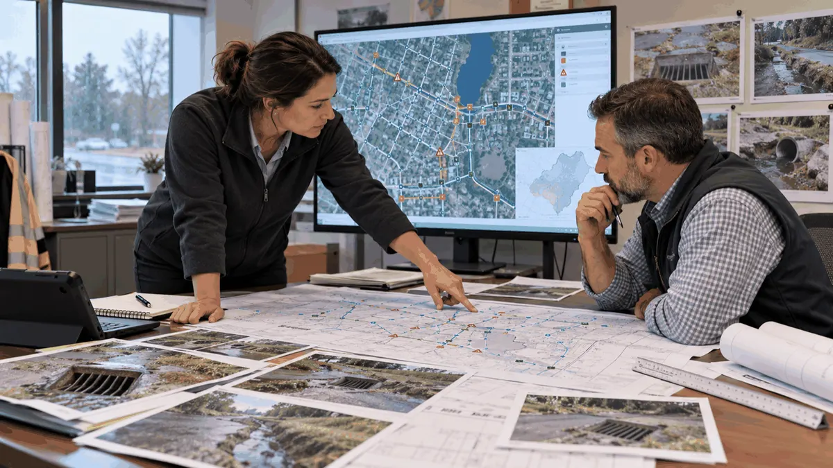
Before a drainage project advances, cities should clarify easement boundaries, access rights, asset ownership, duties, and records needed for inspections.
Stormwater projects often cross parcels, roads, channels, and private facilities. A map may show a pipe or outfall, but it may not explain who can enter the property, who maintains the asset, or whether the recorded easement matches the feature in the field. When those questions remain open, survey, design, construction, and maintenance decisions can become disconnected.
Easement review is therefore a planning task, not merely a closing document. Public works, engineering, GIS, legal, development review, finance, and property staff may each hold part of the answer. A coordinated record helps a city define the next step, prepare documentation, and reduce avoidable review delays. It does not guarantee a permit, approval, funding, or construction outcome.
Who This Affects
Municipal stormwater managers, public works directors, civil engineers, GIS coordinators, surveyors, development reviewers, and capital planning staff all depend on clear property and access information. Counties, utilities, developers, HOAs, and private owners may also have responsibilities for drainage facilities that connect to public systems.
Residents and businesses often experience the problem without seeing the boundary issue. A flooded yard may be upstream of a public inlet. An outfall may sit on private land. A drainage channel may cross several parcels while maintenance responsibility changes at each boundary. Complaints should be preserved as evidence while the ownership and access questions are researched.
Maintenance crews are directly affected by incomplete records. If a crew cannot confirm entry rights, the response may be delayed. If an easement is too narrow for equipment, a planned maintenance method may not be feasible. If an asset has no responsible owner in the database, future inspections may be missed.
The Stormwater Planning Issue
An easement record can include a legal description, plat reference, instrument number, width, purpose, restrictions, access provisions, and maintenance language. The stormwater database may add the mapped asset, field location, condition, photographs, inspection history, and responsible party. These sources should be compared rather than treated as interchangeable.
GIS accuracy matters. A centerline drawn from old plans may not match the built pipe. A scanned plat may be hard to align with current parcels. A facility may have been relocated, extended, or connected to a private system after the easement was recorded. The planning team should assign a confidence level and identify what requires survey or document research.
Ownership is not always the same as maintenance responsibility. A city may own a public conveyance but rely on a private agreement for access. A private facility may discharge to a public outfall under development conditions. A road department may control the right of way while stormwater staff maintain the inlet. The record should show each role separately.
The timing of access matters too. Routine inspection, emergency response, vegetation management, sediment removal, and capital construction may require different equipment and notice. A narrow access route may support walking inspection but not a vacuum truck or excavator. Planning should record the practical limitation instead of simply marking access as yes.
Regulatory context should be handled carefully. NPDES, MS4, construction, industrial, and local stormwater requirements vary by jurisdiction and permit authority. Easement documentation can support planning and inspection records, but it is not itself a permit determination or a guarantee of compliance.
What to Review Before Moving Forward
For each candidate project, the team can review:
- Which mapped assets and drainage paths are included in the project area?
- Do parcel boundaries, easement documents, and field conditions agree?
- Who owns each asset, and who is responsible for inspection and maintenance?
- Does the record authorize access for the proposed work and equipment?
- Are notice, restoration, vegetation, fencing, and surface-use restrictions documented?
- Are private connections, outfalls, channels, or detention facilities involved?
- Is a survey, title review, field verification, or owner coordination still needed?
- What records should be updated after construction or maintenance?
The project file should distinguish confirmed facts from assumptions. A note that says "easement verified" should identify the document, date, reviewer, and feature checked. If the document was unavailable, the record should say so. Clear uncertainty helps managers budget for the next step and avoids treating an unresolved issue as complete.
Field verification should capture access gates, obstructions, slopes, vegetation, crossings, standing water, visible structures, and equipment limits. Photos should show context and location. A map should identify the point of view or asset reference. These details help engineering and maintenance teams make the same interpretation.
Planning, Permitting, or Compliance Support That Fits
GIS and asset-management support can connect parcel records, easements, assets, complaints, inspection history, and capital projects. A structured layer can include document references, responsible party, access limitations, verification date, and confidence. The goal is a reviewable system that staff can update after each field visit.
Civil engineering support may be appropriate when the easement affects pipe alignment, detention, outfall stabilization, flood mitigation, or construction access. Survey and title research may be needed when the record does not match the built condition. Public outreach or owner coordination may be needed before crews enter private land.
MS4 and NPDES program staff may use the information to clarify inspection routes, illicit-discharge response, maintenance responsibilities, and documentation. This support can help prepare records and clarify responsibilities, but it should be described as planning assistance rather than a promise of permit acceptance or regulatory approval.
Capital planning should show the dependency. A project may need easement confirmation before design, design before cost refinement, and owner coordination before construction. Listing the dependency makes the schedule more honest and helps decision makers compare a drainage study, maintenance action, acquisition task, or capital improvement.
Common Mistakes to Avoid
One mistake is assuming that a pipe on public land is automatically a public asset. Another is copying the same owner into every field of a database. Ownership, access, inspection, maintenance, and emergency responsibility may differ.
Teams also rely on a map without checking the document or the field. A line can be shifted by a survey datum, old construction plan, or later modification. A wide easement can be blocked by a fence or steep grade. Records should show the limitation.
Another mistake is waiting until construction to identify the access problem. A project that requires a crane, excavator, or haul route may need a different easement or staging plan than a project that requires a walking inspection. Early review can reduce redesign and coordination delays.
Finally, teams should not describe planning support as a guarantee of a permit, grant, approval, or compliance result. Good records improve decision quality and can support documentation, but the authority, design, and site conditions still determine the outcome.
The same record can support several audiences when it is written plainly. A maintenance supervisor needs to know how to reach an inlet. An engineer needs reliable geometry and constraints. A finance reviewer needs to understand why access work belongs in the project cost. A property owner needs a clear explanation of the proposed entry and restoration. A shared record reduces the chance that each group makes a different assumption from the same incomplete map.
Cities should plan for updates after every field visit, repair, easement change, or capital project. Store the source document with a stable reference, retain the verification date, and record who made the change. If an asset is abandoned, replaced, or transferred, preserve the old record and explain the transition. This history helps future staff understand why a responsibility changed and can make audits or plan reviews easier.
Next Step
Select one drainage asset with recurring complaints or deferred capital work. Compare the asset map, easement record, field condition, owner, maintenance duty, and access route. Record what is confirmed, what is uncertain, and which next action will close the largest gap.
Sources https://www.epa.gov/npdes/municipal-sources-stormwater https://www.epa.gov/npdes/stormwater-discharges-construction-activities