
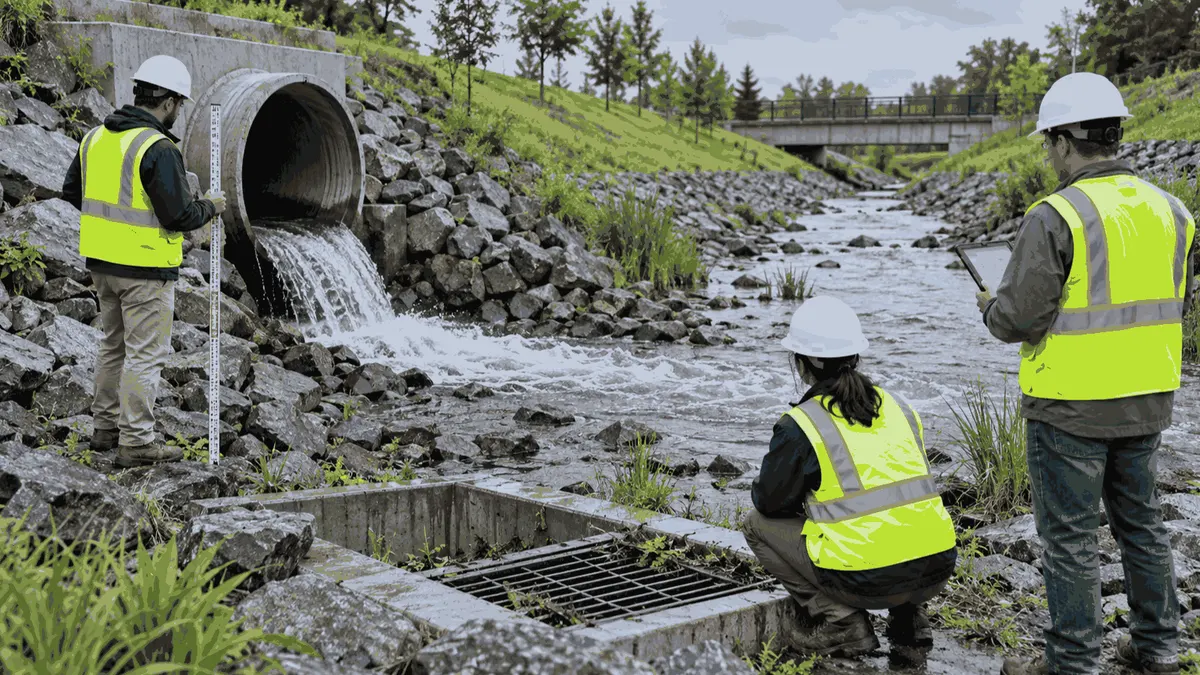
Inspection frequency planning helps stormwater teams connect field visits, changing conditions, maintenance capacity, and records without promising outcomes.
Consider also how the program handles uncertainty. A field inspector may see discoloration without flow, a damaged grate without a clear cause, or a channel that cannot be reached safely. The form should allow the inspector to record what was observed, what could not be verified, and what follow-up is assigned. This is stronger than forcing a definitive answer that the field evidence does not support. It also gives reviewers a clearer account of why a location was revisited or referred.
The frequency plan can be reviewed at a regular program interval. Compare the planned route with actual visits, response times, recurring findings, rainfall patterns, construction activity, and maintenance capacity. Then document the reason for any change. A change may be appropriate because a site was stabilized, an asset was rebuilt, a complaint pattern increased, or a route proved impractical. Keeping the reason with the revision makes the plan easier to hand off and explain.
Who This Affects
Inspection frequency affects municipalities, public works departments, MS4 program managers, developers, construction managers, facility owners, civil engineers, and consultants who need a repeatable way to decide when drainage assets, outfalls, BMPs, and construction areas should be reviewed. The issue is especially important when a team has more locations than it can visit on a single schedule. A calendar that gives every location the same attention may be easy to publish but difficult to defend when conditions and consequences vary.
A frequency plan should reflect the program's purpose. A municipal team may be organizing catch basin inspections, outfall screening, illicit discharge investigations, or maintenance follow-up. A construction team may be tracking perimeter controls, stabilized areas, stockpiles, and temporary BMPs as site phases change. A private facility may need to review exposed materials, drainage paths, spill controls, and housekeeping before and after significant weather. Each setting calls for a different record set and decision process.
The plan also affects the people performing work. Field inspectors need clear routes, safe access, equipment, and criteria for escalating an observation. Supervisors need a way to see overdue visits and unresolved findings. Asset managers need information that can support maintenance and capital planning. Contractors need to understand which observations belong in their daily records and which issues require notification to the owner or program manager.
Inspection frequency is not a substitute for reading the applicable permit, ordinance, SWPPP, MS4 program document, or site-specific plan. It is a planning tool that helps a team organize the work those documents require and identify gaps before they become difficult to explain.
The Stormwater Planning Issue
Stormwater conditions are dynamic. Rainfall intensity, construction phase, vegetation, sediment accumulation, blocked inlets, changing land use, and maintenance work can all alter how water moves. A frequency plan that was reasonable when a project was inactive may not fit during grading, utility installation, or final stabilization. A public works route that was appropriate in dry weather may miss problems after a major storm or upstream construction activity.
The first step is to build a location inventory. Identify outfalls, inlets, channels, detention features, swales, erosion controls, discharge points, and sensitive receiving areas. Give each location a stable identifier and a useful description. A map point alone may not tell the inspector where to park, which direction to walk, or what feature should be visible. Add access notes, ownership, known hazards, and the records that should be attached to the visit.
Next, define risk factors. Consider the potential for sediment movement, illicit discharge, erosion, flooding, public exposure, nearby water resources, recurring complaints, high-flow response, construction activity, asset age, and maintenance history. Avoid turning risk into a false precision score. A simple category such as routine, elevated, or event-triggered can be useful when the team documents why the category was assigned and who may change it.
Event triggers should be explicit. They may include rainfall, a reported discharge, a spill, a construction phase change, a failed BMP, a blocked structure, a complaint, a flood warning, or completion of maintenance. The trigger should lead to an assigned action, time window, field form, and escalation route. If a plan says inspect after a storm but does not define which storms or who receives the result, the instruction is hard to operate.
Frequency should also reflect what the team can complete. An ambitious schedule that produces late or incomplete records is less useful than a risk-based schedule with clear ownership and documented exceptions. Capacity planning should include travel time, weather, safe access, photos, measurements, data entry, follow-up, and the time required to verify a repair.
What to Review Before Moving Forward
Review the current map, asset list, drainage model assumptions, recent inspection records, complaint log, maintenance work orders, construction schedule, and known discharge history. Compare names and identifiers across those sources. A location called Outfall 12 in a field notebook and OF-012 in a GIS layer may be the same asset, but the mismatch can make trend review and handoff harder.
Check whether the route is physically accessible and safe. Some locations may require traffic control, permission, waders, fall protection, a boat, or a second person. Others may be inaccessible during high water. The frequency plan should state what the inspector does when the planned access is unavailable and how the missed visit is rescheduled or escalated.
Review the inspection form itself. It should provide space for date, time, weather or event context, location, observed flow, visible staining or discharge, sediment, erosion, structural condition, maintenance needs, photographs, and follow-up. Not every program needs every field on every visit, but the form should make the required observation obvious. Avoid forms that invite a string of vague yes or no answers with no place for supporting context.
Look at how records are closed. A finding is not necessarily resolved because a work order was created. The program should identify who confirms the action, what evidence is retained, and whether a repeat visit is necessary. For a blocked inlet, the closeout may include a work-order number and a photograph after cleaning. For an erosion concern, it may include a repair description, a date, and a later inspection after runoff.
Finally, review the relationship between inspection results and planning decisions. Recurring sediment at the same inlet may support maintenance-route changes. Repeated outfall complaints may justify a different screening approach. Assets that fail repeatedly may belong in a capital-priority discussion. The inspection program becomes more valuable when findings inform the next budget, design, or operations decision.
Planning, Permitting, or Compliance Support That Fits
A useful support effort may include GIS cleanup, asset inventory design, inspection form development, SWPPP review, BMP tracking, outfall screening procedures, IDDE documentation, drainage mapping, or maintenance workflow design. The goal is to make responsibilities and records clearer. Support can help prepare documentation, organize evidence, and reduce review delays, but it should not promise a permit, grant, approval, or compliance outcome.
For MS4 teams, support may focus on connecting program elements to routes, responsible staff, response times, and record retention. For construction teams, it may focus on aligning the SWPPP, site map, inspection calendar, BMP locations, and phase changes. For facility owners, it may focus on exposed materials, spill response, drainage pathways, and corrective-action records. For public works departments, it may focus on asset condition, service levels, complaints, and capital planning.
Training should be role based. A field inspector needs to recognize and document conditions. A supervisor needs to assign routes, review findings, and approve escalation. A GIS or asset manager needs to maintain identifiers and map edits. A contractor needs to know which site records must be updated when BMPs move. Short exercises using the team's own forms and maps can be more useful than general discussion because they reveal where the handoffs fail.
The planning team should define quality checks. Examples include a monthly review of overdue inspections, a sample comparison of photographs to locations, a check for unresolved findings, and a review of event-triggered visits after significant storms or complaints. These checks support consistent documentation without representing that a spreadsheet alone establishes compliance.
Common Mistakes to Avoid
One common mistake is using a single fixed frequency for every asset. Another is adding event triggers without assigning someone to monitor and act on them. Teams also lose value when field observations are stored in email, photographs lack location references, or the same asset has multiple identifiers.
Avoid treating a completed route as proof that every location was meaningfully inspected. Avoid copying last year's map without checking construction, ownership, drainage, and access changes. Avoid promising that better documentation will guarantee approval or eliminate review comments. Good planning clarifies evidence and responsibility; it cannot control every agency decision or weather event.
Do not close findings only because time has passed. A later photograph, maintenance record, or field verification should support closure when the issue calls for it. When the team cannot verify the result, keep the item open or document the limitation and next action.
Next Step
Select one inspection route and trace three findings from field observation to work order, follow-up, map update, and closeout. Use the exercise to adjust frequency, fields, ownership, and escalation before expanding the process across the program.
Sources
EPA, NPDES Stormwater Program https://www.epa.gov/npdes/npdes-storm-water-program
EPA, Municipal Sources of Stormwater https://www.epa.gov/npdes/municipal-sources
EPA, National Menu of Best Management Practices https://www.epa.gov/npdes/national-menu-best-management-practices-bmps-stormwater-programs