
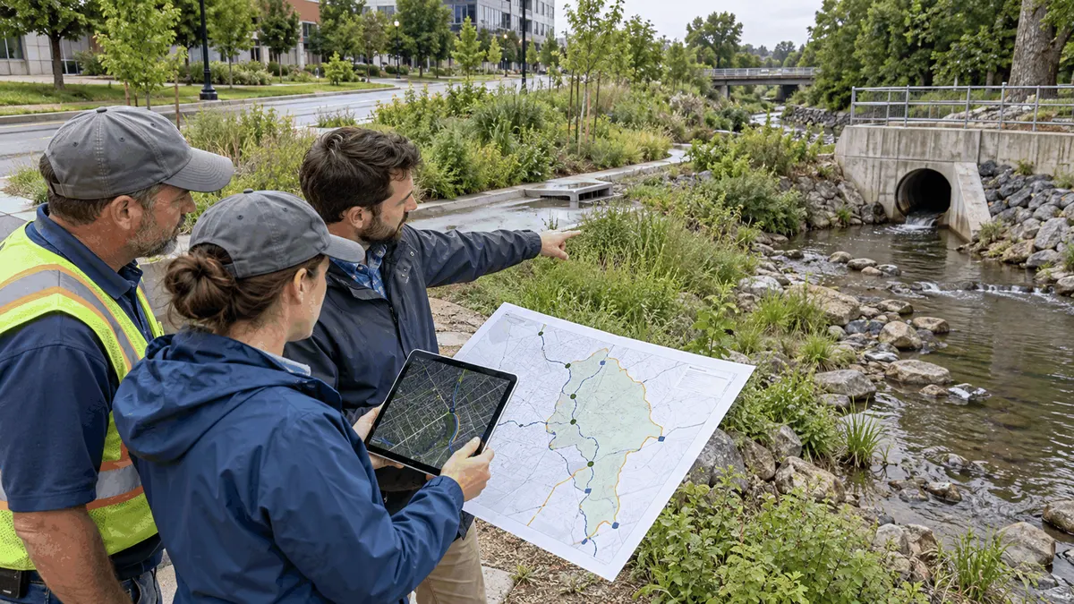
MS4 teams need a clear way to connect each impaired-water pollutant, permit commitment, drainage area, BMP, and supporting record before reporting. A total maximum daily load, commonly called a TMDL, can establish an important planning framework for a specific waterbody and pollutant, but the day-to-day work still depends on the applicable permit, local drainage system, responsible departments, selected practices, and evidence the municipality can maintain.
The practical challenge is not simply finding a TMDL document. Municipal teams must determine what applies to their MS4, where affected drainage areas and outfalls are located, how permit language translates into program work, which best management practices are reasonably connected to the pollutant of concern, and what records support each activity. When those pieces live in separate files, the annual reporting process can become a search for explanations instead of a review of an organized program.
A useful implementation plan creates a traceable chain from the controlling documents to the work performed in the field or through the municipal program. It should distinguish regulatory requirements from voluntary watershed efforts, measured results from modeled estimates, and completed activities from future commitments. This article provides a planning framework, not legal advice. The current MS4 permit, approved TMDL, state or tribal requirements, and direction from the permitting authority should guide final decisions.
Who This Affects
MS4 coordinators and environmental program managers are often responsible for translating permit language into schedules, procedures, and reports. They need a reliable way to show which program elements relate to an impaired waterbody, which department owns each task, and where the supporting record is stored. A clear crosswalk also helps them identify missing evidence before a reporting deadline or program review.
Municipal engineers, GIS staff, and drainage planners help establish the spatial relationship between the regulated storm sewer system and the affected waterbody. Their work may include delineating drainage areas, locating outfalls, reviewing conveyance connections, checking receiving-water information, and documenting uncertainty where field conditions do not match older plans. The map is not the permit decision, but it is a critical tool for organizing the right questions.
Public works supervisors and field crews implement many practices that may support a stormwater program, including inlet cleaning, street sweeping, facility housekeeping, spill response, erosion repair, structural BMP maintenance, and outfall observations. These activities become more useful for TMDL planning when work orders and inspection records use consistent asset identifiers, locations, dates, and completion notes.
Planning, parks, transportation, code enforcement, communications, purchasing, and finance staff may also affect implementation. A nutrient-related strategy might involve fertilizer practices or public education, while a sediment-related strategy might involve construction oversight, erosion repair, or maintenance at known deposition areas. The correct connection depends on the approved TMDL and applicable permit, not on a generic list of stormwater activities.
Watershed organizations, neighboring jurisdictions, consultants, laboratories, and project partners may contribute data or complete shared work. Municipal staff should decide how partner information will be reviewed, attributed, and retained before it is used in a program summary. Clear boundaries help prevent two organizations from claiming the same project or using incompatible reporting periods.
The Stormwater Planning Issue
Connect the TMDL to the Permit
A TMDL identifies a waterbody and pollutant combination, evaluates pollutant sources, and establishes allocations within the water quality planning process. Point sources regulated through the National Pollutant Discharge Elimination System may receive wasteload allocations. That general framework does not mean every TMDL creates the same municipal duties or that a national guidance document replaces permit language. Teams should read the approved TMDL together with the MS4 permit and any referenced implementation requirements.
One common source of confusion is treating an impaired-waters listing, an approved TMDL, a watershed restoration plan, and an MS4 permit as interchangeable documents. They can be related, but they serve different purposes. The implementation plan should record the exact document, pollutant, waterbody segment, effective permit provision, reporting period, and responsible authority used for each decision.
Build a Traceability Chain
A practical traceability chain begins with the applicable requirement or commitment. It then identifies the affected drainage geography, the pollutant or source being addressed, the selected BMP or program action, the responsible owner, the schedule or milestone, the measurement method, and the supporting evidence. If any link is missing, reviewers may have difficulty understanding why the activity belongs in the program or what the reported number represents.
For example, a municipality might perform inlet cleaning throughout the system. That activity can have operational value, but a TMDL implementation record should not automatically convert cleaned inlets or removed material into a pollutant reduction. The team should document why the practice relates to the named pollutant, how locations were selected, what measurement method is being used, and whether the permit or an accepted technical approach supports any quantitative estimate.
Separate Activities, Outputs, and Outcomes
Activities describe what the municipality did, such as inspecting facilities, maintaining BMPs, training staff, or completing a retrofit. Outputs describe immediate, countable products, such as the number of inspections, acres treated, work orders closed, or educational materials distributed. Outcomes concern changes in conditions or pollutant loads. These categories should not be blended because each answers a different management question and may require different evidence.
An implementation plan can track all three categories when appropriate, but it should label them accurately. A completed training session does not by itself demonstrate a water quality change. A modeled load reduction is not the same as a measured change in the receiving water. Careful labels make the program more credible and help staff explain what the available data can and cannot show.
What to Review Before Moving Forward
Confirm the Controlling Information
Start with the current MS4 permit, the approved TMDL and relevant appendices, permit fact sheets or implementation schedules where applicable, and current instructions from the permitting authority. Record document dates and citations so staff can distinguish an active requirement from a superseded draft or earlier permit cycle. EPA tools such as ATTAINS can help teams locate assessment and TMDL information, but state, tribal, territorial, and permit records should be checked for the controlling details.
Verify the exact waterbody segment and pollutant combination. A stream, lake, or estuary may have more than one assessed segment or more than one pollutant of concern. A municipality should not assume that a nearby impairment automatically applies to every MS4 outfall or that one pollutant strategy addresses another. Document unresolved questions and route them to the appropriate authority rather than filling gaps with assumptions.
Review Drainage Areas, Outfalls, and Boundaries
Compare the affected waterbody information with the municipal storm sewer map. Review outfalls, pipes, ditches, swales, culverts, inlets, drainage divides, interconnections, and known areas of public and private drainage. Identify where flow crosses jurisdictional boundaries or enters another regulated system. Note whether the map reflects verified field conditions, record drawings, modeled connections, or assumptions.
Spatial review should preserve uncertainty. An outfall may be mapped but not field verified, a drainage divide may change after redevelopment, or a pipe may connect differently than an old plan indicates. A confidence field or verification status can help teams prioritize follow-up without presenting uncertain geometry as settled fact. The purpose is to support planning and responsibility decisions, not to turn a screening map into a regulatory determination.
Match BMPs to Pollutants and Sources
Build an inventory of structural, operational, administrative, and educational practices that may relate to the affected drainage area. For each practice, record its location or program reach, current condition, responsible owner, implementation status, maintenance needs, and intended connection to the pollutant or source. Include existing practices before proposing new projects so the team can see what is already operating and where evidence is incomplete.
The rationale matters. A practice selected for sediment may not address bacteria, nutrients, metals, or another pollutant in the same way. Public education may support behavior change, but the target audience, desired action, and evaluation method should be clear. Structural BMPs may require design, inspection, and maintenance information before staff can reasonably describe their role. Avoid assigning a benefit solely because a project carries a stormwater label.
Define Measures and Evidence
For every reported measure, define the unit, time period, data source, calculation method, quality check, and record owner. If the program uses a model or spreadsheet to estimate pollutant reductions, preserve the version, inputs, assumptions, coefficients, and reviewer. If field samples or monitoring results are used, document the sampling context and limitations. Do not present a numerical reduction as measured or accepted unless the supporting method and applicable requirements justify that description.
Evidence may include inspection forms, work orders, photographs, maintenance logs, contracts, invoices, training rosters, GIS edits, design records, monitoring data, meeting notes, and partner reports. The plan should identify which record supports which measure. A folder full of documents is not the same as a traceable evidence system if staff cannot connect a reported value to its source.
Assign Owners and Review Dates
Name the department or role responsible for each action, the person or role responsible for maintaining the data, and the person authorized to review the result. Set review dates that match the applicable permit and local workflow. Include a process for staff turnover, contractor changes, corrected data, revised maps, and BMPs that are delayed, replaced, or removed from service.
Shared actions need special attention. If several municipalities fund one watershed project, the agreement should explain who retains design and completion records, how each partner describes its contribution, and how benefits are attributed if the permit allows attribution. The implementation record should not imply that every partner independently completed the entire project.
Planning, Permitting, or Compliance Support That Fits
Use a Pollutant-to-BMP Crosswalk
A crosswalk can organize the program without requiring a complicated new system. Useful fields include the waterbody and pollutant, permit or TMDL citation, drainage area or outfall group, source or concern, BMP or action, responsible role, schedule, measure, evidence location, data limitations, and review status. Stable identifiers allow the table to connect with GIS, work orders, capital project files, and annual reporting records.
The crosswalk should be a management tool rather than a static attachment. Staff can use it to find missing owners, duplicate actions, unsupported calculations, stale maps, or records that do not cover the full reporting period. A version field and change note help explain why an action, boundary, or method changed between reviews.
Link Maps Without Overstating Precision
GIS can display impaired segments, municipal boundaries, storm sewer assets, outfalls, drainage areas, BMPs, monitoring locations, maintenance work, and planned projects. That visual connection can reveal gaps that are difficult to see in separate spreadsheets. Each layer should include its source, date, verification status, and limitations so users understand whether the feature is surveyed, field observed, derived, or approximate.
Map products should direct staff back to source records instead of becoming the only evidence. A map symbol showing a completed BMP should link to or reference the design, inspection, and maintenance information that supports its status. Likewise, an outfall assigned to a drainage area should retain the basis for that assignment and any unresolved connectivity question.
Create a Repeatable Review Cycle
Use a locally appropriate review cycle to reconcile work orders, inspection findings, GIS changes, project status, partner data, and reporting measures. The cycle might align with seasonal operations, budget development, construction closeout, or permit reporting. The important point is to detect discrepancies while staff can still investigate them, not after the reporting package is nearly due.
A concise review agenda can ask whether the controlling documents changed, whether mapped drainage relationships remain accurate, whether planned BMPs were implemented, whether evidence is complete, whether calculation methods were applied consistently, and whether any claim needs qualification. Decisions and corrections should be recorded with the reviewer and date.
A well-built crosswalk supports compliance planning, helps prepare documentation, can reduce review delays, and clarifies responsibilities. It does not promise permit acceptance, regulatory approval, compliance, funding, pollutant reduction, or a particular water quality outcome. Those determinations depend on the applicable authority, requirements, technical evidence, and site conditions.
Common Mistakes to Avoid
Treating Screening Data as the Final Decision
National datasets and online maps are useful starting points, but they may not contain every local update or permit-specific detail. Confirm the applicable waterbody, pollutant, TMDL, permit provision, and drainage relationship through the appropriate records and authority. Keep a note of what was checked and when.
Assigning Every BMP to Every Pollutant
A long BMP inventory can look complete while hiding a weak technical connection. State the purpose of each practice and explain why it is relevant to the pollutant, source, and drainage area. If that connection is still being evaluated, label it as a planning question rather than a completed strategy.
Turning Activity Counts Into Unsupported Reductions
Inspections, cleanings, trainings, repairs, and outreach events are legitimate activities, but their counts should not automatically become pounds removed or water quality improvement. Preserve approved or accepted methods, input data, units, and assumptions for any estimate. Clearly distinguish modeled, calculated, observed, and measured information.
Double-Counting Shared Work
Regional monitoring, watershed projects, and jointly funded BMPs may involve several organizations. Define each partner's role and the attribution method before reporting. A municipality can describe its contribution without representing the entire shared project as solely its own work.
Losing the Reporting Period
Records may be organized by fiscal year, calendar year, construction season, contract term, or permit year. Mixing periods can produce incomplete or duplicated totals. The crosswalk should state the period for each measure and document how late corrections or open work orders are handled.
Hiding Data Gaps
An unknown connection, missing inspection, outdated map, or incomplete partner report should remain visible until resolved. A documented limitation is more useful than an unsupported assumption because it gives the team a specific follow-up action. Track the owner, target date, and effect of the gap on any reported measure.
Next Step
Choose one impaired waterbody and pollutant that appears in the municipality's current stormwater planning materials. Gather the approved TMDL, applicable MS4 permit provisions, current drainage and outfall map, existing BMP list, recent work records, and reporting measures. Confirm which documents are authoritative and note questions that require the permitting authority's input.
Build a one-page pilot crosswalk linking the document citation, drainage area or outfall group, pollutant source, BMP or action, responsible owner, schedule, measure, and evidence location. Test each link by asking whether another staff member could find the source record and understand the basis for the reported statement without relying on institutional memory.
Review the pilot with engineering, GIS, public works, and the MS4 program owner. Correct mapping conflicts, unsupported claims, duplicate measures, and missing responsibilities. Once the structure works for one pollutant and waterbody, expand it carefully while preserving the distinctions among permit requirements, planning assumptions, activities, estimates, and measured results.
Good TMDL implementation planning is not a promise that one table or project will produce a particular regulatory or environmental result. It is a disciplined way to connect controlling information, drainage geography, municipal work, and evidence so the team can make better decisions and explain its program accurately.
Sources
U.S. Environmental Protection Agency, Impaired Waters and Stormwater: https://www.epa.gov/tmdl/impaired-waters-and-stormwater
U.S. Environmental Protection Agency, Overview of Total Maximum Daily Loads: https://www.epa.gov/tmdl/overview-total-maximum-daily-loads-tmdls
U.S. Environmental Protection Agency, Stormwater Discharges from Municipal Sources - Developing an MS4 Program: https://www.epa.gov/npdes/stormwater-discharges-municipal-sources-developing-ms4-program
U.S. Environmental Protection Agency, Effectively Implementing TMDLs: https://www.epa.gov/tmdl/effectively-implementing-tmdls
U.S. Environmental Protection Agency, ATTAINS: https://www.epa.gov/waterdata/attains