
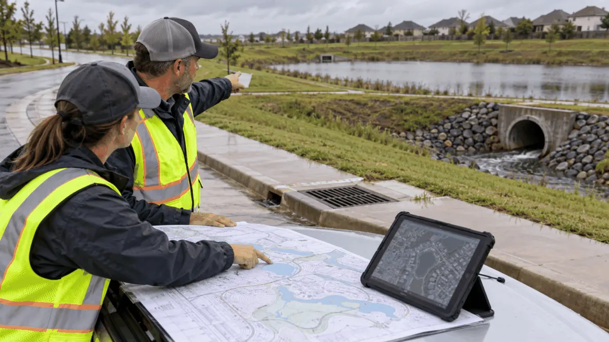
An overflow map helps public works teams see where runoff may travel when pipes, inlets, culverts, ponds, or channels exceed their intended capacity.
Drainage maps often show the normal system: pipes, structures, outfalls, channels, basins, and receiving waters. Severe rainfall, blocked assets, failed pumps, debris, construction, or damaged controls can force water onto a different route. When those emergency pathways are absent from the map, staff may not know which low points, roads, buildings, utilities, or downstream assets require attention first.
Emergency overflow mapping does not predict every storm or guarantee that flooding will be prevented. It is a planning tool that connects field observations, terrain, asset data, maintenance knowledge, design information, and response procedures. Used carefully, it can clarify responsibilities, support compliance planning, help prepare documentation, and improve decisions before and during a storm.
Who This Affects
Public works directors, stormwater program managers, utility crews, GIS staff, civil engineers, emergency managers, transportation departments, parks teams, planners, inspectors, and communications staff all use pieces of the overflow picture. Developers, property owners, homeowner associations, institutions, and private maintenance contractors may also control assets or land that influence a route.
The issue applies to curb-and-gutter systems, roadside ditches, culverts, detention and retention basins, pump stations, underpasses, flood-control channels, green infrastructure, and storm drain networks. It also matters at construction sites and redevelopment projects where temporary grading, stockpiles, erosion controls, or incomplete connections change how runoff moves.
MS4 program staff have an additional interest because system maps, outfalls, illicit discharge detection and elimination, inspection, maintenance, public education, and pollution-prevention activities depend on reliable asset and drainage information. Permit details vary by jurisdiction, so the local NPDES permit, stormwater management program, ordinances, manuals, and emergency plans should guide what the map must contain.
The Stormwater Planning Issue
Water follows grade and available openings, not administrative ownership lines. A pipe may surcharge into a street, cross a park, enter a private swale, pass through a culvert owned by another agency, and reach a receiving water at an outfall managed by the municipality. If those connections exist only in individual staff members' memories, response becomes fragile.
An overflow map should distinguish the designed system from the likely relief system. The designed system includes known pipes, ditches, inlets, junctions, basins, controls, outfalls, and receiving waters. The relief system includes surface low points, road crowns, curb openings, emergency spillways, berm gaps, overland swales, underpasses, disconnected depressions, and routes created when an asset is blocked or overwhelmed.
The map should also distinguish evidence from inference. Surveyed elevations, record drawings, field-confirmed flow directions, inspection photographs, model results, complaint locations, high-water marks, and staff observations have different reliability. A line drawn from terrain data may be a useful hypothesis, but it should not be presented as field-verified infrastructure.
Capacity is not the only concern. Overflow can carry sediment, floatables, fuel, landscaping materials, construction debris, and other pollutants. A bypass route may reach a different outfall or receiving water than expected. Mapping that route can support spill response, IDDE planning, inspection prioritization, maintenance, and documentation, but it does not by itself demonstrate that permit requirements have been met.
Ownership and authority can complicate the response. The municipality may maintain a street inlet but not the private basin upstream. A state transportation agency may own the culvert under a highway. A utility easement may permit access but not authorize every type of work. The map should make these boundaries visible and link them to contacts, agreements, and escalation procedures.
What to Review Before Moving Forward
Begin with source records. Gather storm-system GIS data, record drawings, surveys, grading plans, drainage studies, hydraulic or hydrologic models, maintenance records, inspection reports, permit maps, flood studies, and emergency-response documents. Note the date, coordinate system, source, and known limitations of each dataset. Older plans can be valuable, but field changes and redevelopment may make them incomplete.
Check the asset network for breaks. Pipes without connected structures, duplicate outfalls, reversed flow directions, missing inverts, inconsistent diameters, and assets plotted far from aerial or survey evidence are common data-quality problems. These errors can distort both normal-flow and overflow assumptions.
Review terrain at a useful scale. Broad elevation data may show watersheds and major flow paths but miss curbs, walls, rail lines, median barriers, small berms, doorway thresholds, and recently graded lots. Field verification is important at critical low points and locations where a small elevation difference changes the receiving route.
Walk known trouble spots with operations staff. Ask where water ponds first, which inlet clogs with leaves, where a grate lifts, where a ditch overtops, which access road becomes impassable, and which basin spillway activates. Staff experience should be captured as an attributed observation with a date, not silently converted into a surveyed fact.
Review consequences as well as probability. Sensitive locations may include emergency routes, schools, care facilities, electrical equipment, pump controls, drinking-water infrastructure, sewer assets, steep embankments, occupied basements, construction sites, and waters with special permit or water-quality considerations. A low-frequency route may still deserve priority if the consequences are high.
Evaluate maintenance access. A crew cannot clear a culvert quickly if the gate key, easement, traffic control, vacuum truck position, or safe approach has not been planned. The map should identify practical access points, closure needs, equipment limits, and locations that require coordination with another owner.
Finally, confirm which documents govern action. Local permits, ordinances, emergency plans, road-closure protocols, spill plans, dam or basin procedures, and mutual-aid agreements may assign different responsibilities. The mapping project should reference those documents without replacing them.
Planning, Permitting, or Compliance Support That Fits
A basic planning map may be enough for a small system or a preliminary workshop. It can show known assets, contours, low points, overflow arrows, critical facilities, ownership, and field-verification status. The product should include a legend, date, source notes, and a clear statement of limitations.
A GIS-based operational layer can support larger systems. Useful fields may include asset ID, normal downstream connection, emergency receiving route, trigger condition, owner, maintenance responsibility, inspection date, confidence level, access notes, traffic-control needs, receiving water, and linked photographs or documents. Controlled pick lists and definitions make the data easier to maintain.
Engineering analysis may be appropriate where flow depths, velocities, capacity, structural performance, or design alternatives drive decisions. Modeling should use reviewed inputs and documented assumptions. Results can inform planning, but field conditions, blockages, construction, and storms outside the modeled range can produce different outcomes.
Permit and compliance support should begin with the applicable NPDES permit and stormwater management program. Some programs require maps, outfall inventories, inspection procedures, maintenance practices, or records with specific elements. Organizing overflow information alongside those requirements can help prepare documentation and reduce review delays, but it does not promise approval or a compliance outcome.
Emergency management support should translate technical data into usable actions. A responder may need a short field map, asset ID, safe access route, road-closure point, downstream notification contact, and escalation trigger rather than a full engineering model. Different audiences can use different views drawn from the same controlled dataset.
Capital planning can use the map to connect recurring maintenance and incident data with candidate projects. Repeated inlet bypass, culvert overtopping, eroded spillways, or inaccessible assets may justify scoping, survey, design, or property coordination. Prioritization should consider risk, equity, environmental impact, asset condition, cost, and available authority rather than complaint count alone.
Common Mistakes to Avoid
One mistake is drawing overflow arrows from a desktop without checking the field. Curbs, walls, landscape berms, recent construction, and private drainage features can redirect water. Label unverified routes and schedule targeted field checks.
Another mistake is treating a clean GIS line as proof of capacity or condition. A mapped pipe may be undersized, obstructed, collapsed, disconnected, or built differently from the record. Pair network data with inspections, maintenance history, and design information.
Teams also overlook temporary conditions. Road projects, utility trenches, sediment controls, stockpiles, winter snow, leaf accumulation, and disabled pumps can change overflow behavior. The response plan should identify who reports temporary changes and when the map or incident notes need updating.
A fourth mistake is hiding ownership uncertainty. Assigning an unverified owner can send crews to the wrong contact or create access problems. Use an unknown or pending status, document the evidence, and resolve ownership through records and coordination.
Some maps include so much information that responders cannot use them. Separate planning, engineering, public, and response views while maintaining one authoritative dataset. Protect sensitive infrastructure information and follow local data-sharing policies.
Finally, do not describe overflow mapping as a guarantee of permits, grants, approval, or compliance. It supports planning and documentation. Regulatory decisions remain with the applicable authorities, and funding depends on program-specific criteria.
Next Step
Choose one drainage area with a recurring ponding complaint, a known capacity concern, or a critical road crossing. Build a one-page overflow profile showing the normal drainage route, likely relief route, asset IDs, low points, receiving water, ownership, access, maintenance history, field-verification status, and emergency contacts.
Review that profile in the field with GIS, operations, engineering, stormwater, and emergency staff. Mark disagreements and missing information rather than forcing an immediate answer. Assign each gap an owner, evidence source, and target date, then update the controlled layer and response procedure.
Once the pilot works, apply the same definitions and quality levels across priority basins. Schedule updates after capital projects, major maintenance, development closeout, significant storms, and field discoveries. A map that reflects change is more useful than a polished document that no longer matches the system.
Emergency overflow mapping works best as a shared operational practice. It helps teams connect assets, terrain, field knowledge, permits, maintenance, and response so that the next decision begins with clearer information and assigned responsibility.
Sources
U.S. EPA, Stormwater Discharges from Municipal Sources | https://www.epa.gov/npdes/stormwater-discharges-municipal-sources
U.S. EPA, Developing an MS4 Program | https://www.epa.gov/npdes/stormwater-discharges-municipal-sources-developing-ms4-program
U.S. EPA, Stormwater Discharge Mapping Tools | https://www.epa.gov/npdes/epas-stormwater-discharge-mapping-tools
FEMA, Flood Maps Products and Tools | https://www.fema.gov/flood-maps/products-tools