
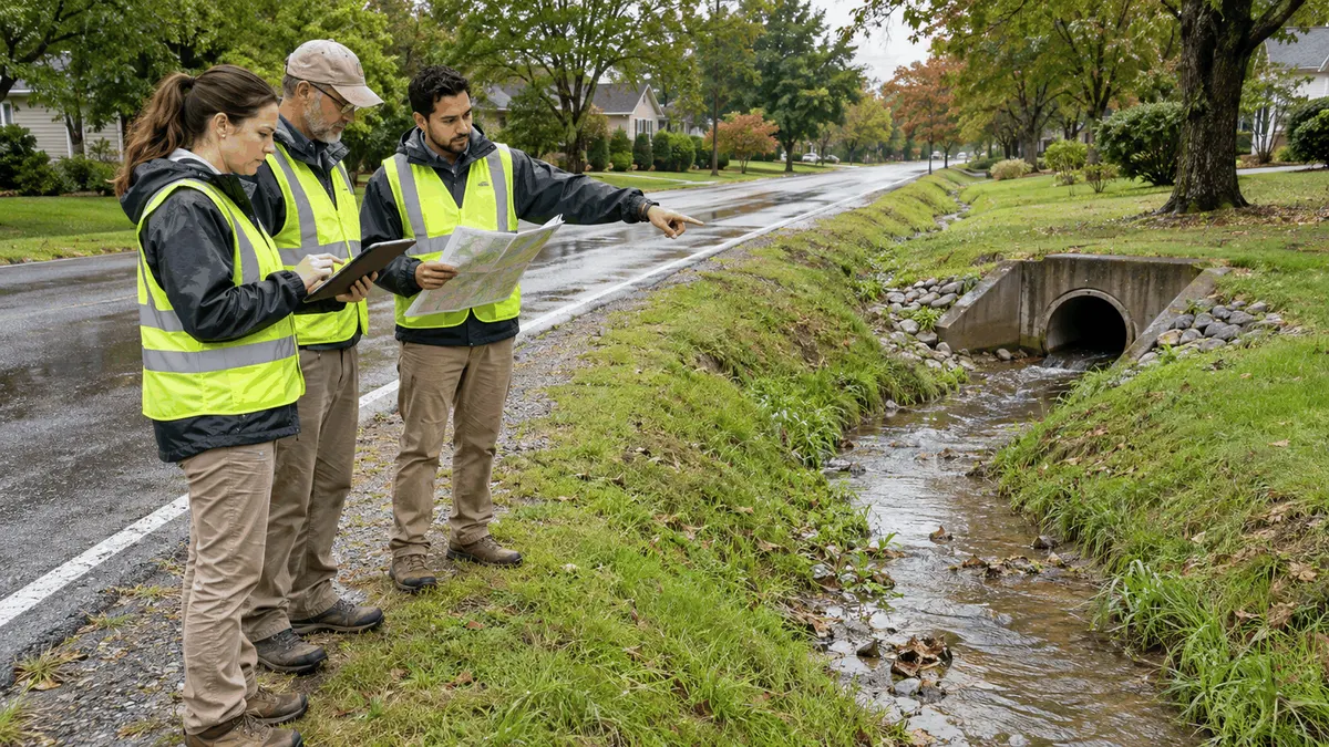
Roadside ditch inspection routes work best when maps, field observations, maintenance records, and drainage priorities describe the same connected system.
Open ditches can look simple on a map, but their performance depends on continuous grades, culvert crossings, inlets, outlets, vegetation, soil condition, driveway modifications, and downstream capacity. A blockage or eroded segment may affect properties far from the visible problem. Municipal separate storm sewer system programs, public works operations, transportation maintenance, and capital planning teams may also hold different pieces of the record. A structured inspection route helps those teams observe the system in drainage order, use consistent condition terms, and send findings to the people who can plan maintenance or further evaluation.
Route planning is not a promise that every drainage problem will be corrected immediately or that a particular action will produce a compliance outcome. It is an operational method that supports compliance planning, helps prepare documentation, can reduce review delays, and clarifies responsibilities. The route should reflect the municipality's permit, local program, safety procedures, maintenance standards, and available resources. Where a ditch is privately owned, outside municipal authority, or connected to another jurisdiction, the record should state that boundary rather than imply control the team does not have.
Who This Affects
Roadside ditch inspection planning affects MS4 coordinators, street and drainage crews, GIS staff, engineers, inspectors, vegetation contractors, emergency managers, call-center staff, and supervisors who prioritize maintenance. It also affects plan reviewers and capital planners when observed conditions suggest a recurring capacity, erosion, or access issue rather than a routine work order. A single field visit may create information used by several groups, so the route and inspection form should collect facts that can move across those workflows without being rewritten from memory.
Residents, property owners, transportation agencies, utilities, and neighboring jurisdictions may also affect the system. Driveway culverts can change conveyance, utility work can disturb slopes, landscaping can redirect runoff, and upstream development can change flow patterns. Inspectors should document what they observe without assigning responsibility beyond the evidence and authority available. Clear location data and photographs make later coordination more productive, especially when ownership or maintenance duty must be researched.
The Stormwater Planning Issue
A ditch is a linear asset with connections. Inspecting only complaint locations can miss an upstream obstruction, a damaged culvert, or a downstream restriction that explains repeated ponding. Conversely, driving a fixed route without using complaint, work-order, and storm information may spend equal time on very different risks. A useful route combines network logic with practical priorities. Teams can group connected segments, identify safe observation points, and set frequencies or event-based checks according to local procedures and known conditions.
The asset inventory is the foundation. Each ditch segment should have a stable identifier or a reliable location reference, start and end points, flow direction when known, connected culverts or inlets, receiving feature, ownership or maintenance status, and access notes. The data does not need to begin perfectly. A field program can confirm and improve it over time. What matters is preserving the link between observations and the same asset so trends, repeated defects, and completed work can be compared.
Condition terms should be specific enough to support decisions. Sediment accumulation, vegetative obstruction, erosion, bank failure, standing water, trash, illicit discharge indicators, culvert blockage, damaged lining, and unauthorized modification are different observations. A single label such as poor condition does not tell a maintenance supervisor what equipment may be needed or an MS4 coordinator whether another procedure should be triggered. Definitions, severity levels, measurement guidance, and photo examples can improve consistency without turning a field inspection into an engineering study.
Dry-weather observations may be important in some MS4 programs because unexpected flow, staining, odor, sheen, discoloration, or deposits can indicate a condition that needs evaluation under local illicit discharge detection and elimination procedures. Inspectors should be trained to record indicators and follow the municipality's notification process. They should not identify a pollutant or source based only on appearance. The response may require separate screening, sampling, tracing, or interdepartmental coordination under approved procedures.
Safety and access shape the route. Roadside shoulders, traffic, steep slopes, water, unstable banks, vegetation, wildlife, and private property can limit where an inspector may stand. Routes should define safe parking or observation locations and when traffic control, additional staff, or specialized equipment is needed. An inaccessible segment should be recorded as such, with the reason and a next step, rather than marked inspected from an unsafe or misleading vantage point.
What to Review Before Moving Forward
Begin with existing maps, drainage studies, complaint records, maintenance history, inspection forms, capital projects, and permit-related procedures. Compare the mapped network with aerial imagery and staff knowledge. Look for missing links at driveway crossings, intersections, road curves, property boundaries, and transitions between open ditch and pipe. Route design should account for how water actually moves, not simply follow street names or political boundaries.
Review the purpose and frequency of each route. A routine condition inventory, pre-storm readiness check, post-storm damage review, dry-weather screening activity, and response to a complaint may use overlapping locations but different questions. Combining purposes can be efficient when the forms and staff roles support it, but an all-purpose checklist can also become too long and dilute critical observations. Define the inspection objective, required fields, escalation triggers, and expected completion time before crews are dispatched.
Clarify which team receives each finding. Routine mowing or debris removal may enter a maintenance queue. Active erosion near pavement may require engineering review. Suspected illicit discharge indicators may follow an IDDE procedure. A blocked cross-drain affecting traffic may need urgent coordination. Unclear ownership may go to GIS, legal, transportation, or property staff for research. These are examples, not universal assignments. Each organization should map observations to its own authority, permit commitments, and operating procedures.
Review data quality rules. Inspectors should know whether the system requires coordinates, asset identifiers, direction of view, date and time, weather, flow condition, dimensions, severity, photographs, and notes. Mobile forms can help, but they should work in areas with weak connectivity and preserve edits or attachments. Required fields should be limited to information the inspector can reliably collect. If a measurement is estimated, the form should distinguish it from a surveyed or instrumented value.
Maintenance history deserves a close look. Repeated vegetation cutting may not resolve sediment deposition, a failing culvert, or an upstream source. A segment that receives frequent work orders may be a candidate for more detailed evaluation or capital planning. The inspection database should allow staff to see prior observations, completed actions, and open follow-up items. That connection supports planning and can reduce duplicate visits or premature closure of a record.
Planning, Permitting, or Compliance Support That Fits
For an MS4 program, roadside ditch inspections may support broader activities involving system mapping, operation and maintenance, illicit discharge procedures, pollution prevention, or documentation required by the applicable permit. The exact obligations vary by permit and jurisdiction. Teams should connect the route to their governing documents and avoid importing a generic frequency or checklist without review. A planning consultant, municipal engineer, permit specialist, or program manager can help reconcile the inventory and workflow with local requirements.
GIS support can improve route efficiency by sequencing connected assets, displaying known defects, and highlighting gaps in ownership or maintenance status. It can also help staff attach field observations to the correct segment and compare inspection history. GIS should not conceal uncertainty. Unknown flow direction, unverified connections, and approximate locations should remain visible until confirmed. A map that distinguishes confirmed data from assumptions is more useful than one that appears complete but cannot be trusted.
Operations support may focus on work-order integration. The inspection result should generate an actionable request with location, condition, priority rationale, access notes, and photographs. When work is complete, the closure record should identify what was done, when, by whom, and whether further observation is needed. This loop helps prepare documentation and clarifies responsibilities between inspection and maintenance groups. It also gives planners evidence about recurring workload and equipment needs.
Engineering or capital planning support may be appropriate when the observed problem exceeds routine maintenance. Persistent erosion, recurring overtopping, damaged structures, unstable slopes, or system constraints can require survey, hydrologic or hydraulic review, geotechnical input, design, permitting, easements, funding decisions, or coordination with other owners. The field route does not make those determinations. It provides organized evidence that helps the responsible team decide what further work is warranted.
Training should cover condition definitions, safe field practices, the use of maps and forms, photo documentation, flow-direction observations, ownership boundaries, and escalation procedures. Refresher sessions can use examples where different inspectors rated the same condition differently. Calibration improves consistency and helps supervisors understand how field judgments are being applied. Training should also make clear which observations inspectors may record and which conclusions require another role or level of review.
Common Mistakes to Avoid
One common mistake is routing by streets alone. That may cause inspectors to jump between unrelated drainage areas and miss the connection between segments. Another is treating every ditch as municipally owned. Ownership and maintenance duty can differ, and the record should preserve that distinction. A third is using severity terms without definitions, which makes priorities depend on who happened to inspect the asset.
Teams also lose value when photographs lack direction or location, when closed work orders are not linked back to the inspection, or when inaccessible areas are silently skipped. Overreliance on complaints can bias attention toward visible locations while less visible upstream or downstream conditions deteriorate. Finally, a route can become stale as roads, culverts, development, ownership, and maintenance practices change. Route review should be a recurring management task, not a one-time map export.
Next Step
Select one drainage area and compare its mapped ditch network with recent complaints, maintenance records, and staff knowledge. Build a short route that follows connected segments, identifies safe observation points, and uses defined condition categories. After the field test, review whether inspectors found the right assets, collected usable data, and sent each issue to a clear owner. Refining one route in this way can create a repeatable model for broader roadside drainage planning without promising a particular permit, approval, funding, or compliance result.
Sources
U.S. Environmental Protection Agency, Stormwater Discharges from Municipal Sources - https://www.epa.gov/npdes/stormwater-discharges-municipal-sources
Electronic Code of Federal Regulations, 40 CFR 122.34, Permit Requirements for Regulated Small MS4s - https://www.ecfr.gov/current/title-40/chapter-I/subchapter-D/part-122/subpart-B/section-122.34