
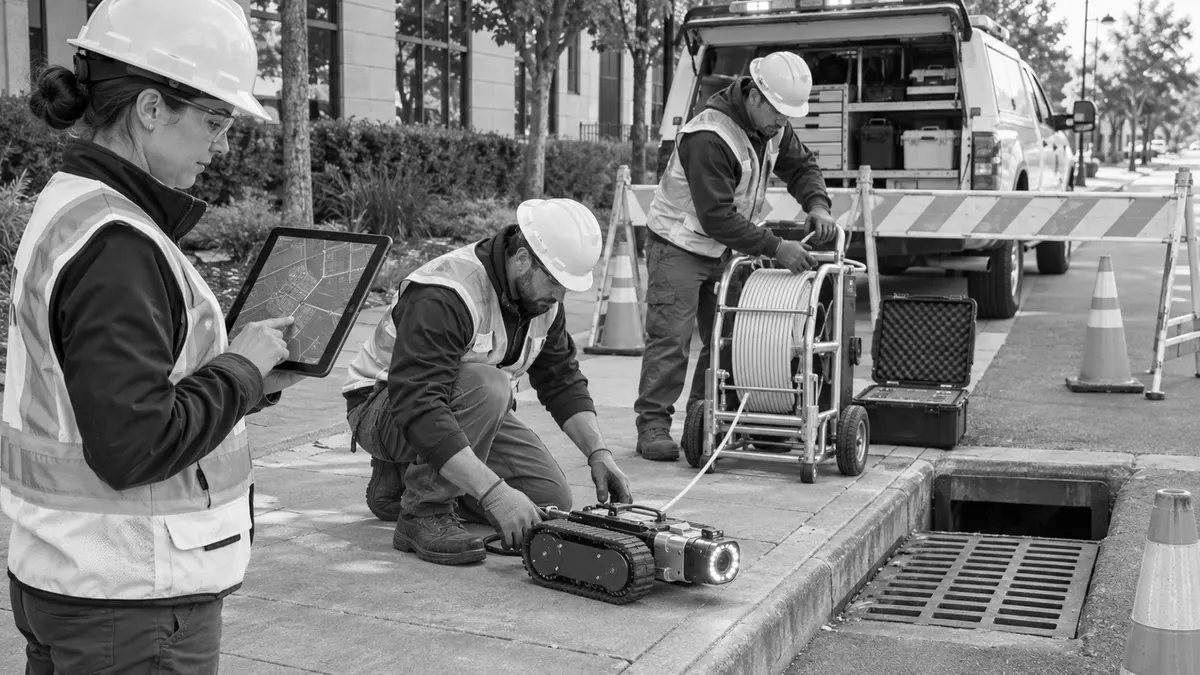
A storm-drain CCTV program is most useful when each video can be tied to a mapped asset, consistent defect codes, and a clear maintenance decision. Without that structure, a municipality may collect hours of footage but still struggle to compare pipe conditions, locate findings, assign follow-up work, or use the results in capital planning.
Closed-circuit television inspection can show cracks, displaced joints, sediment, roots, obstructions, apparent connections, infiltration, and other internal conditions that surface inspections cannot fully reveal. The camera does not decide what the condition means for the system. That requires planning, qualified review, reliable asset data, and a process that connects observations to operations, IDDE work, engineering evaluation, and budgets.
This article describes planning considerations, not a universal inspection standard. Municipalities should align the scope with their MS4 permit, local procedures, procurement requirements, safety program, asset-management practices, and the intended use of the information.
Who This Affects
Storm-drain CCTV planning affects municipal engineers, public works directors, GIS staff, stormwater program managers, maintenance supervisors, IDDE investigators, procurement teams, consultants, contractors, and capital-planning staff. It also matters to reviewers who rely on condition data for rehabilitation projects, drainage studies, road work, utility coordination, and development closeout.
Small communities may contract the entire effort. Larger utilities may own camera vehicles, cable reels, crawlers, software, and inspection databases. The planning needs are similar in either case: define the assets, objectives, data fields, field constraints, quality checks, deliverables, and decision rules before deployment.
Property owners and project developers may also be affected when private systems connect to public infrastructure or when inspection deliverables are required for acceptance. Responsibilities should be stated clearly. A municipal CCTV program does not automatically authorize access to private property, assign ownership, or transfer maintenance obligations.
The Stormwater Planning Issue
CCTV footage is easy to collect and difficult to manage if each inspection uses a different naming method. A video labeled "Main Street pipe" may not identify the upstream structure, downstream structure, flow direction, pipe segment, date, operator, or reason for inspection. Six months later, staff may know that a defect was recorded but not which asset requires work.
The planning issue is broader than file naming. The municipality needs to decide why a segment is being inspected and how the result will be used. A condition-assessment program may prioritize structural defects and service problems. An IDDE investigation may look for flowing connections, leaks, or evidence that helps trace a discharge. A preconstruction survey may document baseline condition. A postconstruction review may verify that a new segment is clear and matches submittal requirements. Each objective can require different timing, equipment, coding, and review.
EPA guidance on illicit discharge investigations describes video testing as a method for guiding a camera through storm-drain pipe to locate a connection producing a discharge. It notes that video can show flows, leaks, cracks, and pipe damage, while also recognizing limitations. Video may not detect a discharge that is not flowing during the survey. That caution should shape the scope and prevent teams from treating a clean-looking recording as proof that no illicit connection or intermittent problem exists.
EPA also identifies CCTV as a widely used condition-assessment technology and explains that condition data can be integrated with asset-management systems to inform costs and capital planning. The value comes from the connection between inspection results and the systems used to manage work, not from the footage alone.
What to Review Before Moving Forward
Begin with a written purpose statement. Define whether the program supports routine condition assessment, complaint response, blockage investigation, IDDE tracing, acceptance, warranty review, rehabilitation design, road-project coordination, or a combination. Then define what decision the inspection is expected to support.
Asset inventory and route definition
Each planned segment should have a unique asset identifier linked to the municipality's map or asset register. At minimum, teams often need the upstream and downstream structure identifiers, direction of inspection, pipe size, material if known, approximate length, location, ownership, access constraints, and connectivity. Unknown attributes should be marked as unknown rather than copied from an unverified assumption.
Review network topology before routing crews. A map may contain disconnected lines, reversed flow arrows, duplicate identifiers, missing structures, or geometry that does not match the field. CCTV work is an opportunity to improve data, but crews need a controlled method to report discrepancies without silently overwriting the official record.
Prioritization should reflect the objective. Factors may include complaint history, flooding, known sinkholes, age, material, critical facilities, road classification, planned paving, repeated maintenance, outfall proximity, suspected cross-connections, and consequence of failure. The municipality should document why some segments are included and others deferred.
Field feasibility and safety
Conduct a desktop and field review of access. Note traffic exposure, structure condition, pipe diameter, bends, grade changes, sediment, standing water, submerged outlets, debris, roots, steep terrain, easements, locked areas, and environmental constraints. The inspection method must fit the pipe and conditions.
Opening a manhole, vault, inlet, or outfall can create fall, traffic, atmospheric, biological, and other hazards. CCTV does not always require entry, but field crews still need applicable traffic control, lifting methods, guarding, PPE, hygiene, and confined-space procedures. The scope should identify responsibility for safety planning rather than treating it as an equipment detail.
Precleaning can improve visibility, but cleaning may mobilize sediment or pollutants, require waste handling, or disturb evidence relevant to an investigation. The team should decide when cleaning is appropriate, how removed material will be managed, and whether an initial recording is needed before cleaning.
Inspection and coding requirements
Define camera capabilities, lighting, position, travel speed, image orientation, distance measurement, pan-and-tilt needs, and the treatment of laterals or connections. Specify when an inspection is considered incomplete and how blocked or inaccessible segments will be documented.
Use a controlled defect dictionary and condition-rating method appropriate to the program. Codes should distinguish structural defects, operation and maintenance conditions, connections, infiltration, deposits, obstacles, and observations that require engineering review. Provide definitions, severity rules, and examples so different operators classify similar observations consistently.
Avoid using a code as a final engineering decision. A visible crack may require more context about pipe material, loading, location, deformation, soil, and hydraulic performance. The inspection record should make uncertainty visible and route significant findings to qualified review.
Data and deliverables
Specify the relationship among video files, inspection reports, still images, GIS features, work orders, and condition ratings. Filenames should include or reliably resolve to the asset identifier, direction, and date. The municipality should define video format, image resolution, metadata, naming, folder structure, and whether proprietary software is needed to view the deliverable.
Require a segment-level summary that identifies start and end structures, inspected length, direction, operator, equipment, date, weather or flow context, reason for inspection, completion status, significant observations, and recommended next action. GPS or map edits should follow a review process before entering the authoritative GIS.
Data ownership and retention belong in the scope. The contract should state who owns raw and processed files, how long the contractor retains copies, how records are transferred, and what happens if software or cloud access changes. Municipalities should avoid receiving an inaccessible database without exportable videos and tabular data.
Quality assurance
Quality review should sample more than file presence. Check that the recording covers the assigned segment, identifiers match the map, direction is correct, distance is plausible, video is viewable, defects are coded consistently, and significant observations appear in the summary. Compare footage with field logs and structure photographs where appropriate.
Set a correction process and acceptance window. If a segment must be re-inspected because of missing footage, poor visibility, incorrect identification, or incomplete reporting, responsibilities and timing should be clear. Early review of a pilot batch can prevent the same error from affecting the entire system.
Planning, Permitting, or Compliance Support That Fits
A focused inspection plan supports compliance planning by connecting field observations with mapped assets, documented procedures, and assigned follow-up. It helps prepare documentation for program reviews and can reduce review delays when reviewers receive consistent identifiers, usable videos, clear summaries, and traceable decisions. It also clarifies responsibilities among field crews, GIS staff, engineers, contractors, and maintenance teams.
For IDDE work, CCTV may be one tool in a broader investigation that includes outfall screening, mapping, sampling, dye testing, smoke testing, interviews, or property coordination. The plan should state the limits of video and define how suspected connections or flows will be escalated. A CCTV result does not by itself promise a permit outcome or demonstrate that every discharge pathway has been found.
For asset management, the inspection program should feed risk and work processes. Findings may generate immediate cleaning, spot repair, engineering review, monitoring, rehabilitation design, or capital-project candidates. The municipality should define who confirms each action and how completion is recorded.
For development acceptance or rehabilitation design, the scope may need different thresholds, survey control, deliverable formats, or professional review. Confirm local criteria before field work. Consistent planning can improve submittal completeness, but it does not guarantee approval, permits, funding, or compliance outcomes.
Common Mistakes to Avoid
Do not begin with a camera vendor and only later decide what questions the inspection should answer. Define the decision need first.
Do not inspect segments that lack stable asset identifiers. Temporary identifiers can be used, but they need a controlled crosswalk to the official map.
Do not accept video without direction, distance, date, and segment endpoints. A clear image is not useful if it cannot be located.
Do not mix coding systems without a translation method. Condition trends become unreliable when the same observation receives different meanings across years or contractors.
Do not treat every observed connection as illicit or every dry connection as acceptable. Findings require context and, where appropriate, further investigation.
Do not ignore access, traffic, structure opening, or confined-space hazards because no one plans to enter the pipe. Surface work can still present serious risks.
Do not let proprietary software become the only way to access public records. Require durable exports and define data ownership.
Do not upload raw results directly into the authoritative GIS without review. Field corrections should be verified and documented.
Do not issue work orders without closing the loop. The program should record whether cleaning, repair, engineering review, or additional investigation occurred.
Next Step
Choose a small pilot area with known assets, a manageable variety of pipe conditions, and a clear operational question. Build the asset list, review access, define inspection and coding rules, specify deliverables, and test the quality-review process on the first few segments before expanding.
After the pilot, compare planned length with completed length, identify data mismatches, review coding consistency, assess file usability, and trace several findings into actual work decisions. Revise the scope and procedures while the sample is small. A well-planned CCTV program turns footage into evidence that public works teams can locate, interpret, assign, and use over time.